A climatografia é a reconstrução do clima do passado a partir de registros históricos e arqueológicos: crônicas de mosteiros, diários de bordo, datas de colheita de uvas, preços do trigo, relatos de rios e portos congelados, fronteiras de cultivo que avançaram e recuaram, as marcas deixadas pelas geleiras, anotações fenológicas, etc. Antes dos termômetros, e muito antes dos satélites, era o próprio homem que servia de instrumento.
Hubert Horace Lamb (1913–1997) passou décadas cruzando documentos históricos com registros naturais, deu nome e forma as variabilidades climáticas do holoceno, e em 1972 fundou a Climatic Research Unit (CRU), na Universidade de East Anglia, justamente com o propósito de reconstruir o registro do clima natural. Obras como Climate: Present, Past and Future e Climate, History and the Modern World seguem como referências obrigatórias.
"When the Climatic Research Unit was founded it was clear that the first and greatest need was to establish the facts of the past record of natural climate, in times before any side effects of human activities could be important."
— Hubert Lamb, em sua autobiografia Through All the Changing Scenes of Life: A Meteorologist's Tale (1997)
Nenhum artigo encontrado.
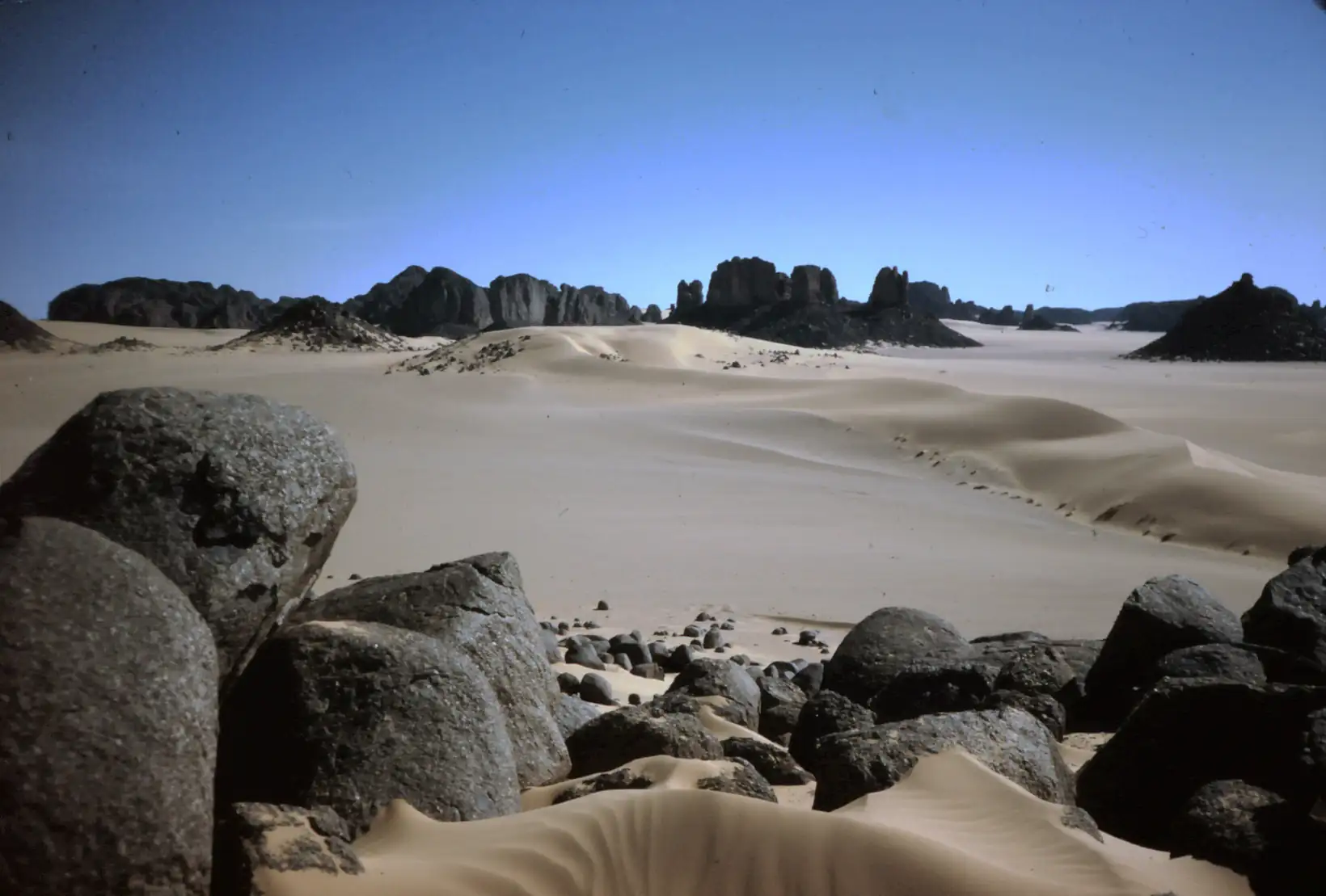
The Green Sahara — Tassili Rock Art, Lake Chad and the Holocene Optimum
Location: Sahara Desert (Tassili n’Ajjer, Algeria; Tibesti, Chad; Lake Chad basin; Nile Valley, Egypt)
Continent: Africa · BP range: bp-03000-09000 (multi-period file spanning optimum through decline)
Geographic scope: Northern Africa broadly — from the central Sahara to the Nile Delta, with hemispheric parallels
Description
Between roughly 7000 and 3000 BC, the Sahara was not a desert. Rock paintings in the central Sahara depict hippopotamus hunts conducted from canoes, herds of cattle grazing on open savanna, and elephants, rhinoceroses, crocodiles and giraffes roaming a landscape that today receives virtually no rainfall. Lake Chad — now a shallow, shrinking remnant — was an inland sea the size of the Caspian, its waters 30–40 metres higher than the modern surface. Permanent rivers flowed from the Tibesti Mountains across terrain that has not seen running water for five millennia. Lamb called this period the “Climatic Optimum” (index, p. 414: “‘Climatic Optimum’ see postglacial warmest time”) — warmth was optimal for life, and nowhere was this more visible than in Africa.
Then the climate cooled. The Piora Oscillation (~3500–2800 BC) pulled the monsoon southward, the rivers dried, the lakes shrank, and the megafauna vanished from North Africa within centuries. Populations that had been dispersed across a habitable savanna were squeezed into the Nile valley — and from that forced concentration, Egyptian civilization emerged. When even the Nile floods failed, around 2180 BC, the famines that followed brought the Old Kingdom to its end. Rock paintings, lake shorelines, pollen cores, fish bones and inscribed stone tablets all converge on the same arc: warmth greened the Sahara; cooling created the world’s greatest desert and reshaped human history.
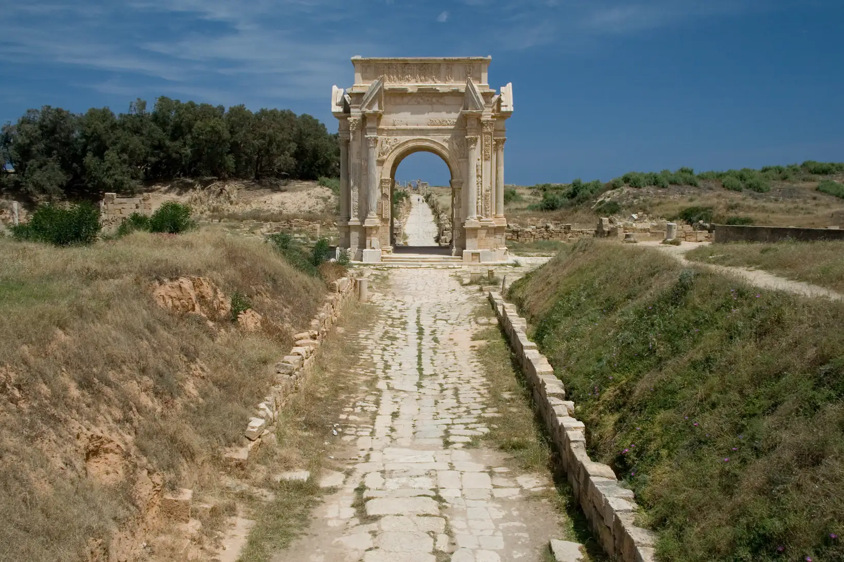
The Green Sahara — Tassili Rock Art, Lake Chad and the Holocene OptimumLer maisRoman Warm Period — Climate, Empire and the Granary of Rome
Location: North Africa (Tunisia, Libya, Algeria, Egypt), Mediterranean Basin, central and northern Europe
Continent: Africa (primary anchor: North Africa as Rome’s granary) · BP range: bp-01500-02000
Geographic scope: Roman world broadly — North Africa, Italy, Britain, Dacia (Romania), Central Asia
Description
The Roman Warm Period (“Roman Climate Optimum”) spans roughly 200 BCE to AD 400, with its warmest and most stable phase concentrated between about AD 1 and AD 300. It followed a cooler, stormier interval of roughly 600–300 BCE — a period Lamb traces through Greek evidence: the historian Rhys Carpenter noted that the Greeks of early classical times had switched from the “semi-nudity” and flat-roofed architecture of warmer Mycenaean and Minoan civilization to “warmer clothing and pitched gable roofs” (p. 167), signalling a real cold and wet deterioration. The recovery from that cooling phase is precisely what powered the Roman empire.
Lamb’s key synthesis statement (p. 168): “There was a continued tendency towards recovery of warmth in Europe through Roman times, and of increasing dryness, until about AD 400.” The evidence for this warming comes from at least seven independent strands: botanical proxies (beech retreat, vine and olive expansion), agronomic records (Roman horticultural writers), a contemporary weather diary from Alexandria, a major civil-engineering marker (Trajan’s Danube bridge), trans-continental trade evidence (the Silk Road), and sea-level data pointing to a thermal maximum around AD 400. Crucially, Lamb also notes that this warming produced, for a long while, a moister regime in North Africa and the Near East than exists today — the climatic foundation for Rome’s African granary.
Roman Warm Period — Climate, Empire and the Granary of RomeLer maisTimbuktu, the Mali Empire, and the Little Ice Age Sahel
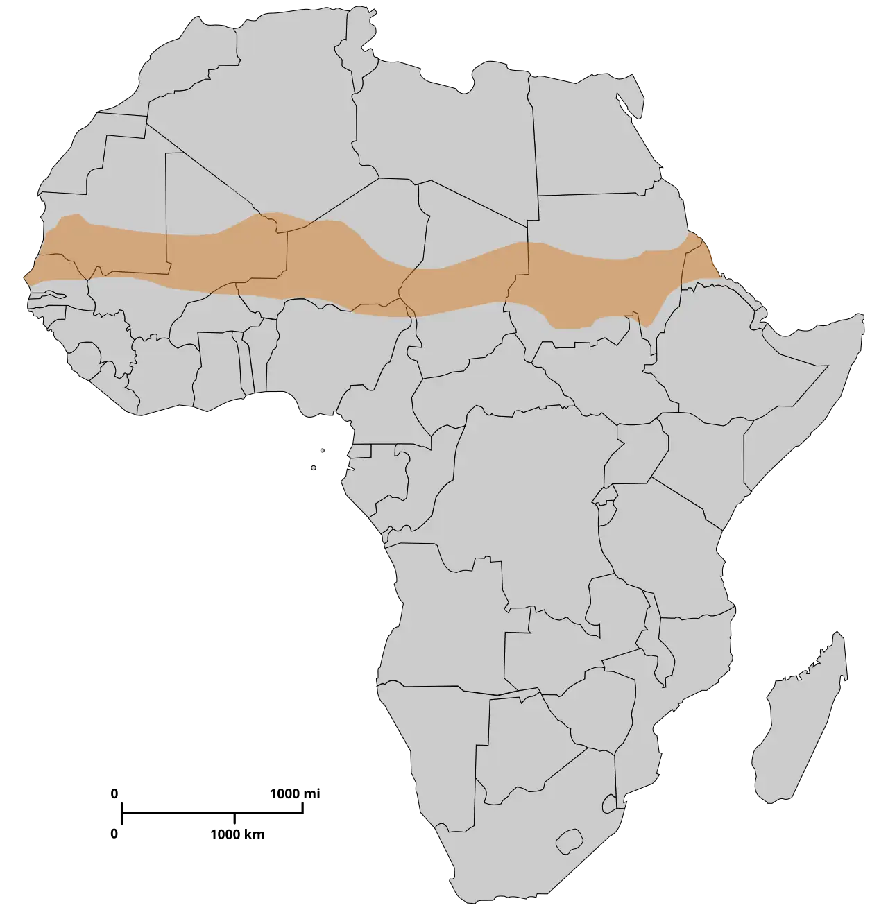
Location: West Africa — Sahel zone, Niger River bend (Timbuktu 16°37′N 2°36′W), Lake Chad basin, Mauritania, Ethiopia
Continent: Africa · BP range: 200–1250
Description
West Africa’s medieval heyday rested on a wetter Sahara. Between roughly AD 700 and 1200, the summer monsoon rains migrated reliably to 15–20°N and beyond, watering a Sahel zone more productive than any European traveller of the Little Ice Age could have imagined. Arab geographers recorded journeys across regions where the desert had not yet closed, and the Lake Chad pollen record confirms the botanical reality of that moisture. The Mali Empire — the largest political entity in medieval West Africa — was the human expression of those centuries. Its collapse began precisely as the rains retreated.
What followed the medieval optimum is documented with unusual precision for tropical Africa: a chronology of Niger River floods and Sahel famines, preserved in the two great Arabic chronicles written in Timbuktu itself, that maps the crisis year by year from 1592 to 1743. The paradox at the heart of this record — that the worst Sahel droughts often coincided with the worst Niger floods — reveals the mechanism. When the West African monsoon was suppressed southward by the same atmospheric forcing that produced the Little Ice Age in Europe, rainfall was concentrated at 10–12°N (Guinea, the Niger headwaters) rather than reaching the bend of the river at Timbuktu (16°N). The river flooded; the city thirsted.
Timbuktu, the Mali Empire, and the Little Ice Age SahelLer maisAlaska and Yukon — Warm Tree Growth During the Early Little Ice Age
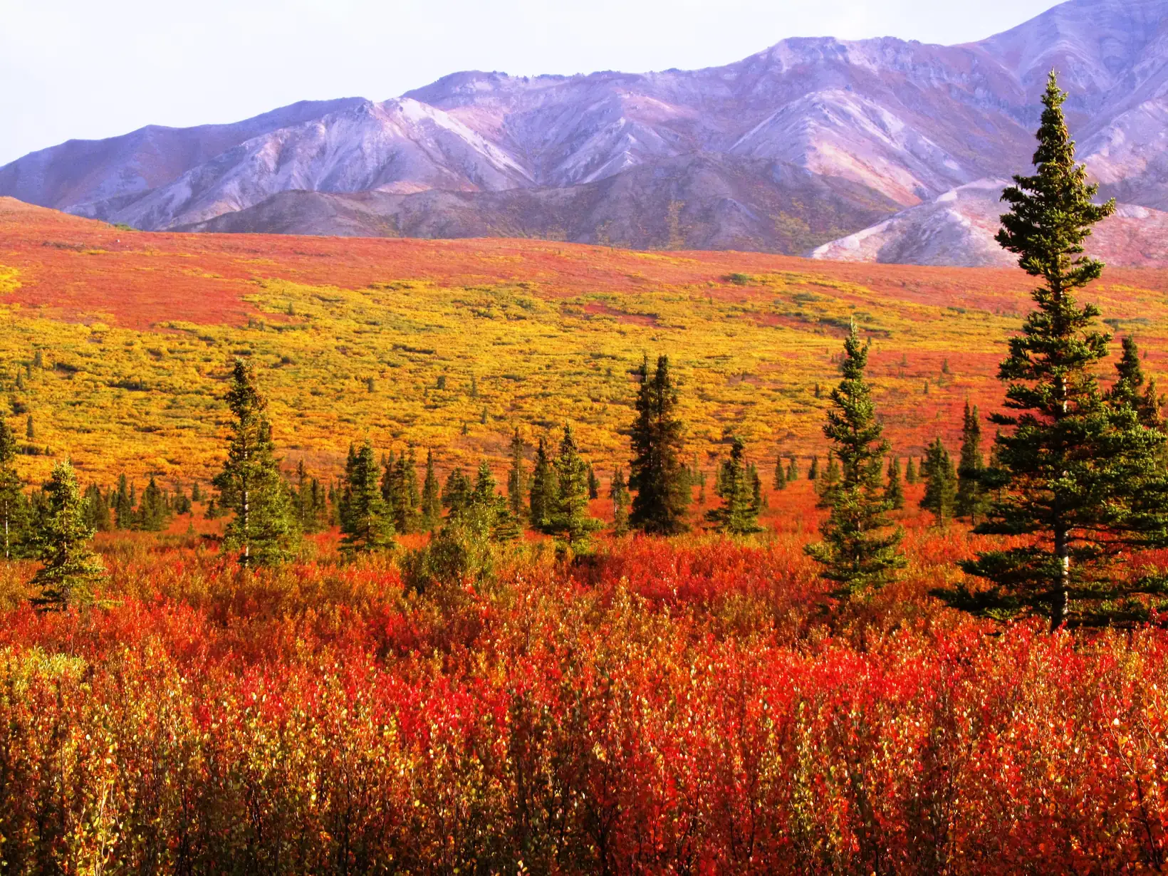
Location: Brooks Range, Wrangell Mountains, Firth River (northeastern Alaska); Yukon Territory, Canada
Continent: Americas
BP range: 350–550
Evidence types: Dendrochronological · Atmospheric science
Description
While the 15th and 16th centuries saw advancing glaciers, failed harvests, and abandoned farms across Europe, tree-ring records from Alaska and the Yukon tell a different story. Boreal white spruce at the northern treeline recorded good growth through the 1400s and well into the 1500s — conditions inconsistent with the severe cooling that was already devastating mid-latitude agriculture. The pronounced Little Ice Age cold that would eventually reach even the North American subarctic arrived decisively only with the Maunder Minimum (1645–1715), a full century after Europe’s crisis had begun.
Lamb recognized this pattern, noting on p. 291 of Climate, History and the Modern World that “there is similar evidence from Alaska and the Yukon” to match the warm tree-ring signal he documented in Lapland. The mechanism linking both regions is the same: blocking anticyclones over the high north created warm, sunny conditions at extreme latitudes while channeling cold Arctic air southward into the mid-latitudes. Alaska and Lapland sat on opposite sides of the Northern Hemisphere but on the same side of the atmospheric equation — both in the warm ridge axis of the blocking pattern.
Alaska and Yukon — Warm Tree Growth During the Early Little Ice AgeLer maisCalifornia / Rockies Neoglacial Onset — The End of Post-Glacial Warmth in North America (~1500–1300 BC)
Location: White Mountains of California; U.S. Rocky Mountains; Gulf of Maine coast; New Mexico and Arizona
Continent: Americas · BP range: bp-02000-03000 (approx. 3450–3250 BP, within the 1050–50 BC range)
Description
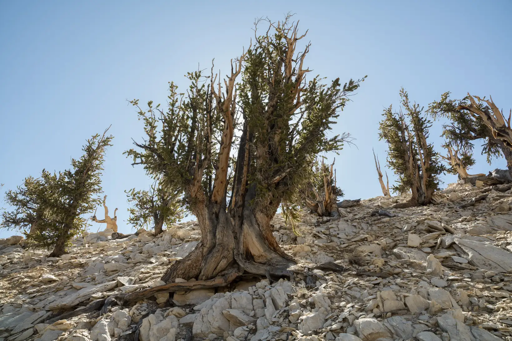
The middle of the second millennium BC marks one of the sharpest climatic transitions in the post-glacial record of North America. Around 1500 BC, conditions that had sustained warmer-than-present temperatures for over four thousand years — allowing treelines 150 metres above their modern positions, sustaining early agriculture in the American Southwest, and keeping Gulf Stream water against the New England coast — permanently deteriorated. Four independent lines of evidence — dendrochronological, glaciological, oceanographic, and archaeological — converge on this single threshold. Lamb called it the moment when the Neoglacial began “in earnest.”
The transition was not uniform. The first pulse arrived around 1500 BC and affected glaciers, ocean circulation, and agriculture. A second, sharper pulse arrived around 1300 BC, clearly visible in the bristlecone pine ring record. For North America as a whole, Lamb judged the cooling trend from 1500 BC onward to have been “the sharpest” of any region on the planet.
California / Rockies Neoglacial Onset — The End of Post-Glacial Warmth in North America (~1500–1300 BC)Ler maisEskimo Migrations and the Repeating Climate Cycle: Dorset and Thule Cultures, Canadian Arctic
Location: Canadian High Arctic, northern Greenland (Peary Land, Independence Fjord), Hudson Bay, Labrador, Nunavut
Continent: Americas · BP range: ~700–4500
Cross-references: Norse Greenland Colony Extinction · California & Rockies Neoglacial Onset
Description
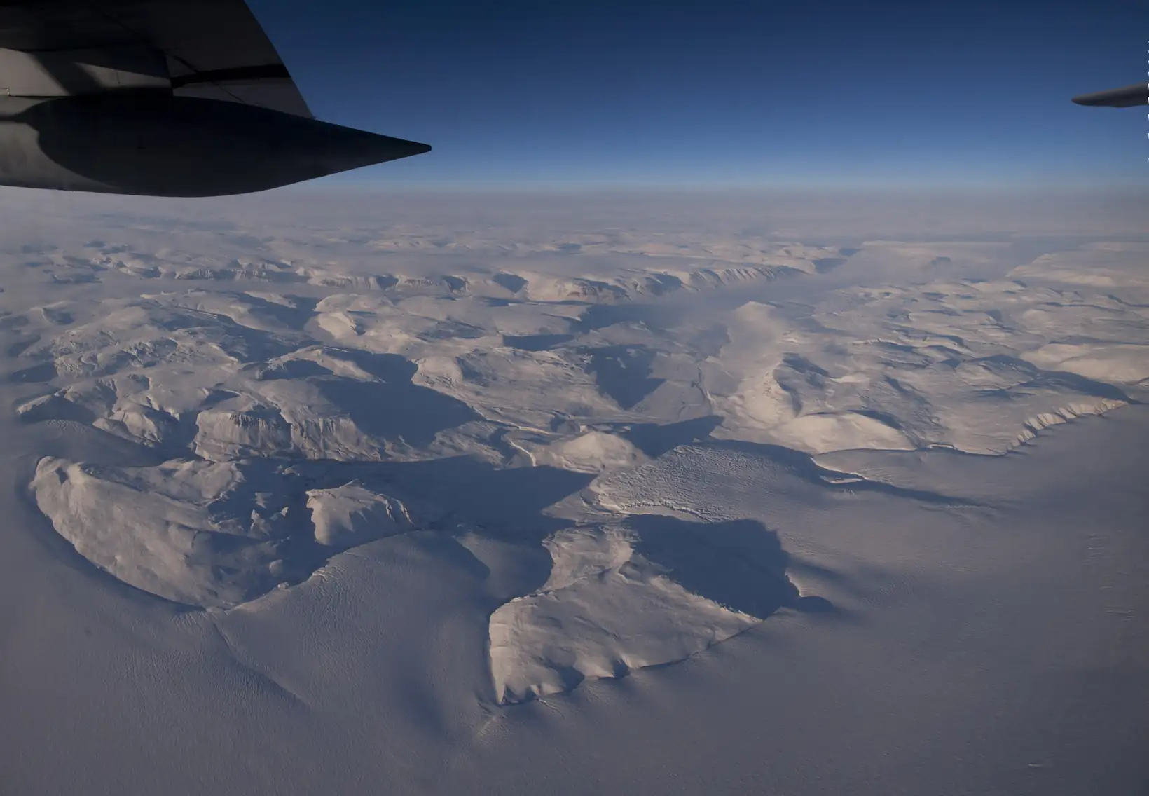
The Canadian High Arctic and northern Greenland preserve one of the longest and best-documented records of climate-driven human migration on the planet. Across nearly four thousand years — from the first Paleo-Eskimo arrivals around 2500 BC through the southward retreat of the Dorset culture before the Thule around AD 1200 — the archaeological record traces at least three complete warm-cold cycles, each producing the same pattern: populations pushed northward into the High Arctic during warming phases, then retreating south when temperatures fell and sea ice expanded.
H.H. Lamb identified this pattern across pages 162–163 and 195–196 of Climate, History and the Modern World. The archaeological evidence is unusually clear because these cultures left almost nothing but physical remains and tool assemblages: the stratigraphy of camp sites, the distribution of dated middens, the presence or absence of hearths and tent-ring clusters at specific latitudes are the primary language of this story.
Eskimo Migrations and the Repeating Climate Cycle: Dorset and Thule Cultures, Canadian ArcticLer maisLittle Ice Age Colonial North America (1600s–1860s) — Frost, Glaciers, and the Reshaping of a Continent
Location: North America — Virginia, New England, Canadian Arctic (Baffin Island), Pacific Northwest, Great Plains
Continent: Americas · BP range: ~85–350
Cross-reference: California & Rockies Neoglacial Onset — the glaciers that expanded from 1500 BC advanced to their Holocene maximum during this same LIA period.
Description
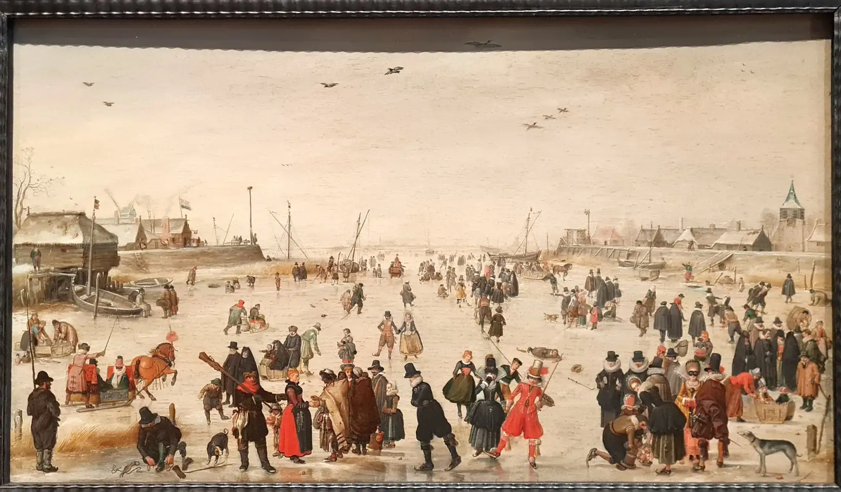
European colonists who crossed the Atlantic in the early 1600s stepped into one of the coldest centuries of the past two millennia. The Little Ice Age — whose European violence they knew from frozen Thames winters, harvest failures, and alpine glaciers grinding through mountain villages — was not a local phenomenon they could leave behind. It followed them. The same atmospheric shift that produced 17th-century frost fairs on London’s river produced bearing ice in Virginia, frozen harbors in New England, and a Baffin Island blanketed under permanent ice and snow across 70 percent of its surface. From Jamestown’s desperate first winters to the anomalously cold decades of the 1830s–1860s documented by the earliest American weather stations, the Little Ice Age left its imprint on every stage of North American colonization.
Six independent evidence strands document this cold episode and its consequences:
Little Ice Age Colonial North America (1600s–1860s) — Frost, Glaciers, and the Reshaping of a ContinentLer maisMesoamerica’s Climate Opposites — Valley of Mexico and the Maya (~500 BC–AD 1520)
Location: Valley of Mexico (19–20°N) and Maya lowlands (14–25°N), Mesoamerica
Continent: Americas · BP range: 430–2450
Three peaks of human settlement coinciding with cold epochs in Europe and North America
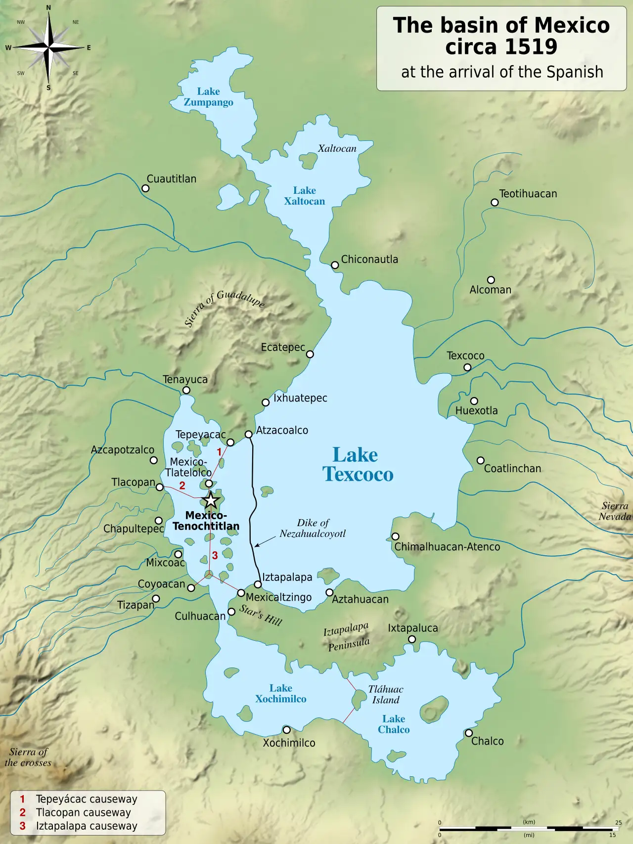
H.H. Lamb draws on the foundational Basin of Mexico settlement-pattern survey to identify three distinct peaks of maximum human settlement in the Valley of Mexico before European contact: approximately 500–100 BC, more briefly around AD 800, and again during three or four centuries of the Aztec period, particularly the century up to AD 1520. He notes that these peaks “coincide with the main periods of colder climate in Europe and much of North America.”
Mesoamerica’s Climate Opposites — Valley of Mexico and the Maya (~500 BC–AD 1520)Ler maisAbandoned Farming Settlements of the Medieval American Midwest: Mill Creek Culture, Iowa, and the Collapse of ca. AD 1200
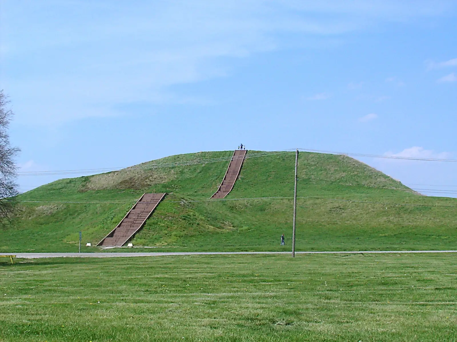
Location: Northwestern Iowa (Big and Little Sioux River valleys; Cherokee and O’Brien counties); Cahokia, Illinois; Mesa Verde, Colorado; Chaco Canyon, New Mexico; Texas Panhandle; Colorado Plateau, Arizona
Continent: Americas · BP range: 700–900 (covering the Medieval Warm Period expansion ca. 950–1250 CE and its collapse)
Description
Across the American Midwest and Southwest, the Medieval Warm Period (ca. AD 900–1250) enabled an extraordinary expansion of maize-based agricultural societies northward and westward onto the Great Plains. As westerly winds weakened and shifted north, the rain-shadow of the Rockies shrank, moister conditions prevailed on the prairies, and woodland advanced at the expense of open grassland. Farming peoples moved with the changing climate: northwestward into Wisconsin, up the Mississippi valley into Minnesota, and onto the plains of northwestern Iowa.
The Mill Creek culture of northwestern Iowa is among the best-documented of these medieval agricultural societies. Archaeological studies by David A. Baerreis and Reid A. Bryson of the University of Wisconsin, published as a multi-part series in the Journal of the Iowa Archaeological Society (vols. 15–16, 1967–1968), traced the entire arc of the culture from its maize-farming expansion through to its abrupt disappearance after AD 1200. Their work combined excavation of village sites with pollen cores and faunal analysis, providing an unusually complete picture of how the climate shift drove cultural collapse.
Abandoned Farming Settlements of the Medieval American Midwest: Mill Creek Culture, Iowa, and the Collapse of ca. AD 1200Ler maisThe Great Warming and Its End — Prairie Expansion, Early Agriculture, and the Elm Decline in North America (~6000–2800 BC)
Location: North America — Great Plains, American Southwest, Upper Midwest, New England
Continent: Americas · BP range: ~4800–8000

Description
Between roughly 6000 and 3000 BC, North America was a different world. Prairie grassland reached where deciduous forest stands today. Agriculture took root in what is now desert. The Gulf Stream hugged the coast of Maine. It was warmer — globally, by 1–3°C compared to the twentieth century (Lamb, p. 128) — and the continent bore the imprint of that warmth in its vegetation, its peoples, and its geography. Then, between approximately 3500 and 2800 BC, the warmth broke. The elm declined in forests from Minnesota to New England. Glaciers advanced in the Alps — the first major advance in millennia. The Sahara dried. The Nile floods weakened. Agriculture vanished from the American Southwest for two thousand years. The same cooling pulse struck on both sides of the Atlantic simultaneously, leaving identical fingerprints in pollen cores, tree rings, ocean sediments, and glacier moraines.
Five independent strands of evidence document this arc from peak warmth to the first great cooling:
The Great Warming and Its End — Prairie Expansion, Early Agriculture, and the Elm Decline in North America (~6000–2800 BC)Ler maisNorse Greenland Colony: Founding, Prosperity, and Total Extinction (985–ca. 1540 CE)
Location: Southwest Greenland — Vesterbygd (Western Settlement) and Østerbygd (Eastern Settlement)
Continent: Arctic–Antarctic · Core BP ranges: bp-00400-01000
Event: The only well-documented complete extinction of a European colony in the pre-modern era, directly linked to climate deterioration
Description
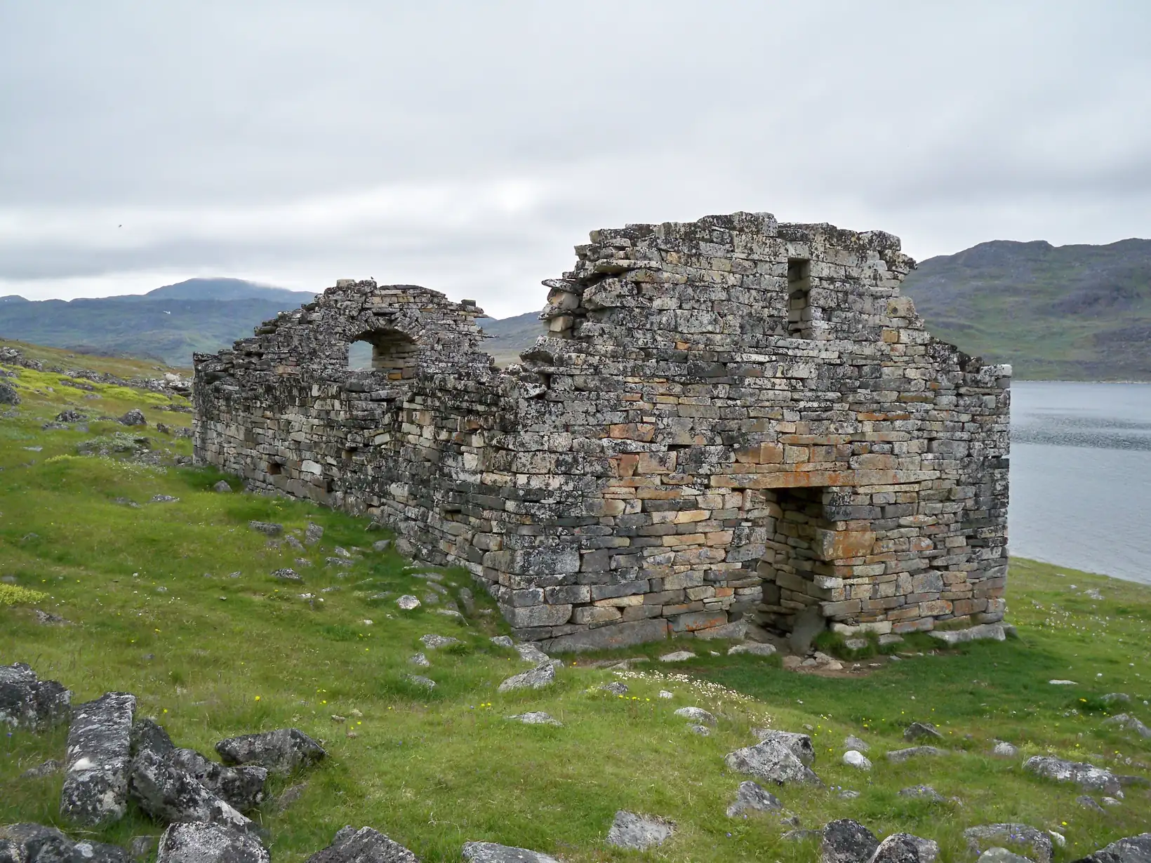
The Norse colony of Greenland is the most completely documented case of a European civilization erased by climate change. Founded by Erik the Red in 985 CE during the Medieval Warm Period at its height, the colony grew to approximately 300 farms, two cathedral-scale settlements, a bishop's see at Garðar, and an estimated population of 2,000–5,000 people. It conducted transatlantic trade in walrus ivory, furs, and live polar bears; it sent explorers to North America five centuries before Columbus; and it endured for nearly 500 years. Then, as the climate deteriorated through the 12th–15th centuries, sea ice closed the sailing routes, cattle farming became impossible, dietary collapse set in, trade ceased, and the last Norse Greenlanders died or vanished without a record. A ship from Hamburg found one dead Norse body around 1540 and no living inhabitants at all.
The evidence spans every strand — documentary, archaeological, skeletal, zooarchaeological, isotopic, and climatological — and the contrast between the warm-period prosperity and the cold-period extinction is one of the most powerful demonstrations of climate's capacity to destroy human civilizations that the historical record provides.
Norse Greenland Colony: Founding, Prosperity, and Total Extinction (985–ca. 1540 CE)Ler maisAncient China — Bamboo at the Yellow River, the Yang-shao Collapse, and 5,000 Years of Climate Oscillation
Location: Yellow River (Huang He) basin; Han River valley (33°N); Shantung province; central China lowlands
Continent: Asia · BP range: bp-02000-07000 (multi-period file spanning warmth peak through Warring States)
Geographic scope: Central and eastern China — from the Loess Plateau and Yellow River basin to the Yangtze and Han River lowlands
Description
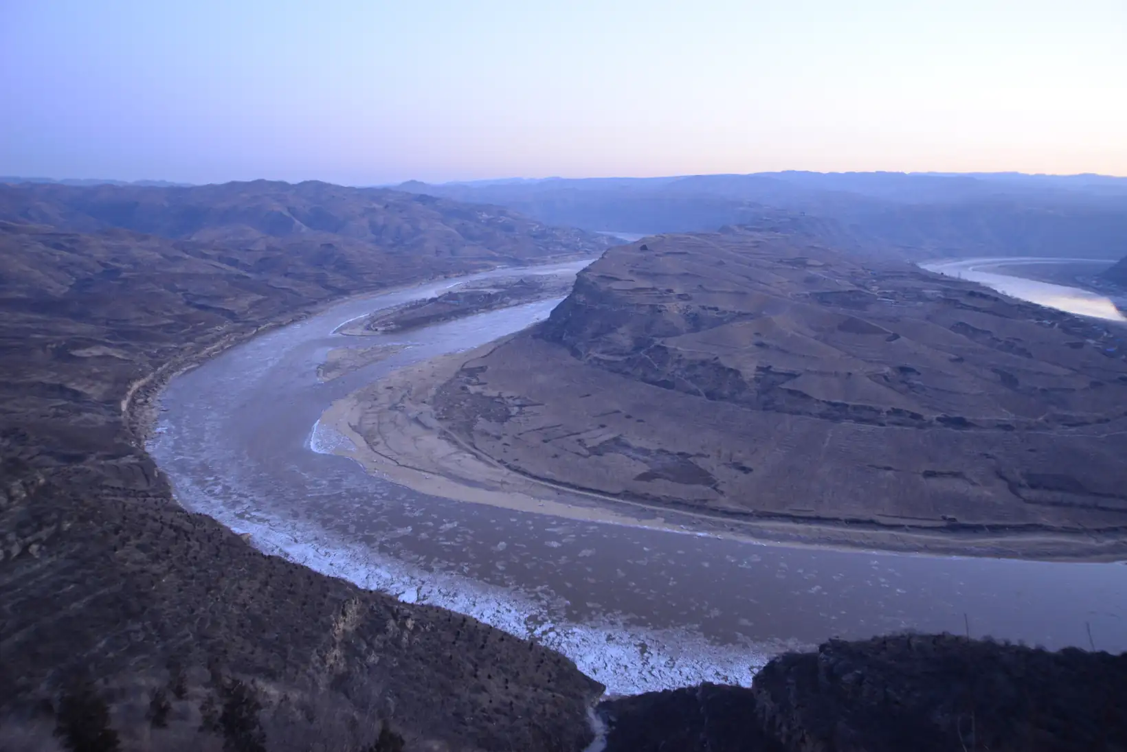
The question of why the great early civilizations appeared where and when they did has an answer that is partly climatic. In China, the period roughly between 5000 and 1500 BC coincided with a warmth so pronounced that the landscape itself looked fundamentally different: bamboo forests spread across the Yellow River lowlands, rice could be sown a full month earlier than it is today, and snow was a rarity in central China. When that warmth began to fade after about 1500 BC — and collapsed more decisively around 1100–800 BC — the consequences were archaeological, agricultural, and military: a Neolithic culture overwhelmed, harvests delayed, rivers freezing, and a period of political fragmentation that would last centuries.
The evidence for this complete arc — warmth, collapse, oscillation — was assembled over a lifetime by the Chinese meteorologist and geographer Zhu Kezhen (known in older Western transliteration as Chu Ko-chen), whose 1973 paper in Scientia Sinica reconstructed 5,000 years of Chinese climate from phenological records in classical literature, oracle bone inscriptions, official histories, and agronomic documents. Lamb drew extensively on Chu Ko-chen’s synthesis, describing it as one of the most complete regional climate reconstructions available for any part of the ancient world.
Ancient China — Bamboo at the Yellow River, the Yang-shao Collapse, and 5,000 Years of Climate OscillationLer maisAngkor and the Collapse of the Khmer Empire — Monsoon Failure and the Transition to the Little Ice Age
Location: Angkor (Yasodharapura), Siem Reap Province, northwestern Cambodia (13°24′N, 103°52′E)
Continent: Asia · BP range: 500–700 (collapse phase) · empire founded bp-01000–01500

Description
The Khmer Empire, centered on the hydraulic city of Angkor in northwestern Cambodia, was from approximately 900 to 1200 CE the most extensive and populous urban civilisation on earth. At its peak in the 12th century the Greater Angkor complex covered roughly 1,000 km² — far larger than any contemporary European city — and supported a population estimated at 750,000 or more. The entire urban fabric was sustained by one of the most sophisticated water management systems ever built in the pre-industrial world: a dense network of barays (reservoirs), canals, embankments, and temple moats that captured seasonal monsoon runoff and redistributed it through the year for wet-rice agriculture.
Lamb places Angkor explicitly in a climatic context, noting that the Khmer capital “was founded in AD 860 and flourished for four or five centuries before disappearing in ruins into the increasing jungle” (p. 180). He draws a direct parallel with the Maya, noting that in both cases “there is clearly a strong case for believing that some climatic shift was at work” (p. 180). The difference in timing between southern Mexico and Cambodia, Lamb suggests, “may reasonably be related to the difference of a few degrees of latitude and, presumably, some changes in the incidence of the southeast Asian monsoon” (p. 180).
Angkor and the Collapse of the Khmer Empire — Monsoon Failure and the Transition to the Little Ice AgeLer maisCaspian Sea Level Cycles, Arabian Drought, and the Mongol Expansion
Location: Central Asia, Arabian Peninsula, Caspian basin, Mongolian steppe
Continent: Asia · BP range: bp-00650 to bp-01650 (spanning multiple intervals)
Description
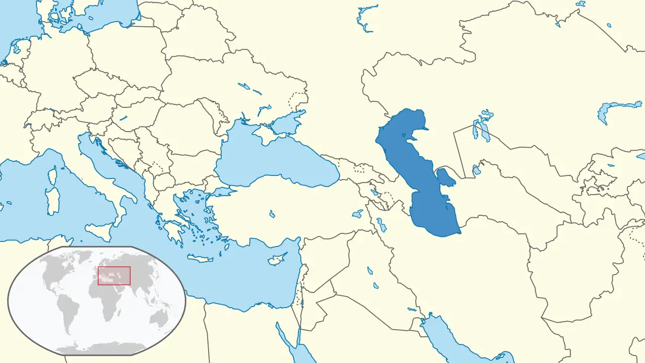
Between AD 300 and 1300, the Caspian Sea oscillated dramatically in response to shifting precipitation across central and western Asia. These oscillations — falling to extreme low-stands during drought maxima around AD 300–400 and again around AD 800, then rising during the moister conditions of the early 13th century — left a physical record in sediments, shoreline archaeology, and historical documents. What makes this proxy so powerful is its reach: the Caspian catchment drains roughly 3.1 million km² of Eurasia, meaning its level integrates climate signals from the Urals to the Caucasus. When it fell, the drought it reflected drove barbarian peoples off the Asian steppe westward into Europe; when it rose, a moist and productive steppe gave birth to the Mongol empire.
Lamb draws a direct line between these water-level fluctuations and three of the most consequential events in world history: the barbarian migrations that destabilised Rome, the emergence of Islam from a drought-stressed Arabia, and the eruption of Genghis Khan’s horsemen across Eurasia. Each occurred at a distinct moment in the Caspian cycle. Together they suggest that hydro-climatic variability in central Asia was not merely background noise but an active force shaping the political history of the medieval world.
Caspian Sea Level Cycles, Arabian Drought, and the Mongol ExpansionLer maisChina from the Silk Road to the Little Ice Age — Climate, Dynasty and Catastrophe, 150 BC to 1880 AD
Location: China (broadly), Central Asia (Sinkiang, Caspian basin), Japan (Kyoto), Taiwan
Continent: Asia · BP range: bp-00000-02100 (multi-period file spanning Roman Warm Period through modern era)
Geographic scope: East and Central Asia — from the oases of Sinkiang to the rice fields of Kiangsi; from the Forbidden City to the Philippine Sea
Sequel to: ancient-china-bamboo-warmth-yangshao-collapse.html (covers prehistory to ~200 BC)
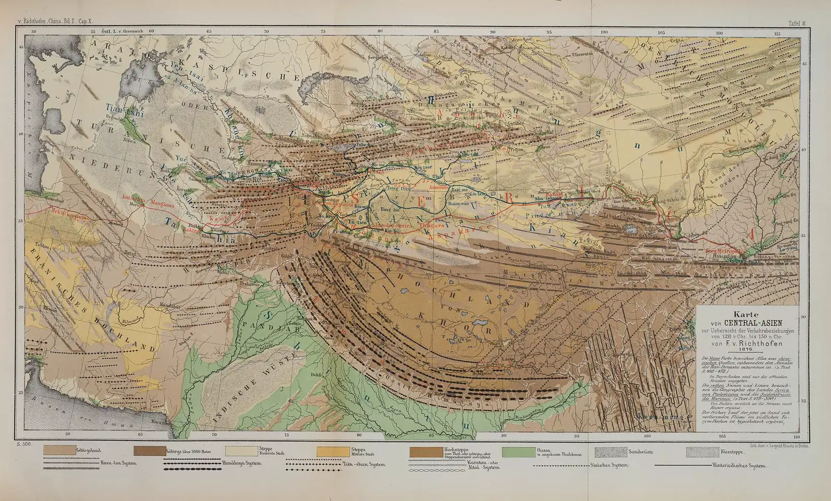
Description
In the ninth century AD, cherry blossoms opened earliest in Kyoto’s imperial gardens — the warmth of the Tang dynasty was at its peak. Two hundred years later, the same blossoms opened a full fortnight later than they had in those golden autumns. It was not that gardeners had changed their methods. The climate itself had shifted. China and Japan had cooled sharply at precisely the moment when Europe was entering its Medieval Warm Period — the warmth that would allow Norse settlers to farm in Greenland, grapes to ripen in England, and cathedral towns to rise across northern France.
This anti-phase relationship — China cold when Europe warm, China warm when Europe was experiencing the Dark Ages cold — is the central discovery documented in this file. It is not an anomaly requiring explanation. It is what physical climatology predicts: a circumpolar vortex tilted asymmetrically will warm one longitude belt while cooling the opposite one. The cherry blossom dates from Kyoto confirm it. The abandoned oases of Sinkiang confirm it. The orange groves that flourished for centuries in Kiangsi province and then suddenly could not survive the winters confirm it. This is not one story about China. It is the story of how climate works — regionally, not uniformly.
China from the Silk Road to the Little Ice Age — Climate, Dynasty and Catastrophe, 150 BC to 1880 ADLer maisIndus Valley & Mesopotamia — Rise and Fall with the Holocene Climate
Location: Indus Valley (Pakistan/NW India); Mesopotamia (Iraq); Arabia; Central Asia
Continent: Asia · BP range: bp-02000-07000 (multi-period file spanning warm optimum through decline)
Geographic scope: South and Southwest Asia broadly — from the Thar Desert and Rajasthan through the Tigris-Euphrates lowland to the Arabian Peninsula
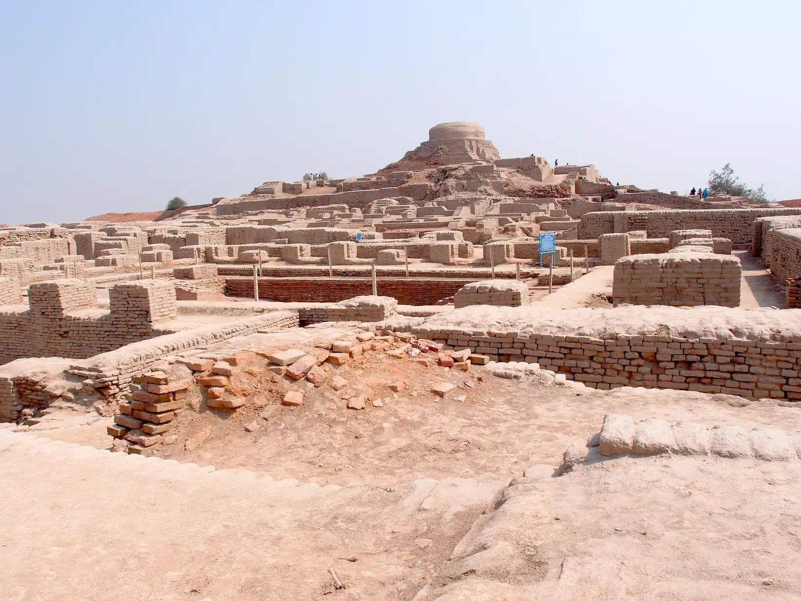
Description
The question of why the great early civilizations appeared where and when they did is answered, at least in part, by the climate. The river valleys of the Tigris and Euphrates, the Indus and the Nile did not attract civilization simply because they were fertile: they were the last refuge of populations driven out of a vast surrounding territory that was turning to desert. Between about 5000 and 2000 BC, the lands now occupied by the Saudi Arabian desert, Afghanistan, Rajasthan and the Gobi had not yet completed their drying. Cultivation was possible 50 kilometres north of where it is feasible today in Mesopotamia. A normal year in what is now the Thar desert of Rajasthan brought 400 to 800 millimetres of rain. The cities of Harappa and Mohenjodaro rose in a landscape of wheat, barley and elephants.
Then the climate dried. The process was neither sudden nor uniform, but its direction was unmistakable: river levels fell, oases shrank, farmland retreated, and the great urban centres of the Indus lost the agricultural base that had sustained them. By 1700 BC the Harappan civilization had effectively ended. When the Aryans arrived, they hugged the rivers and never spread out as the Harappans had done — the water was no longer there to permit it. When Alexander the Great marched through the region in 330 BC, his officers recorded relic water sources and residual vegetation that were surviving on the last reserves of an earlier, moister climate. The Ziggurat of Ur, built when Mesopotamian population density was the highest it would be for two thousand years, rose from fields that are today uninhabitable desert.
Indus Valley & Mesopotamia — Rise and Fall with the Holocene ClimateLer maisJapan — Cherry Blossom Proxy, Lake Suwa Ice Record, and the Great Famines
Location: Kyoto (Kinki region, Honshū) · Lake Suwa (Nagano Prefecture, central Honshū) · Tōhoku (northern Honshū)
Continent: Asia
BP range: Multiple intervals: bp-00070-00500 (LIA), bp-00950-01150 (MWP peak)
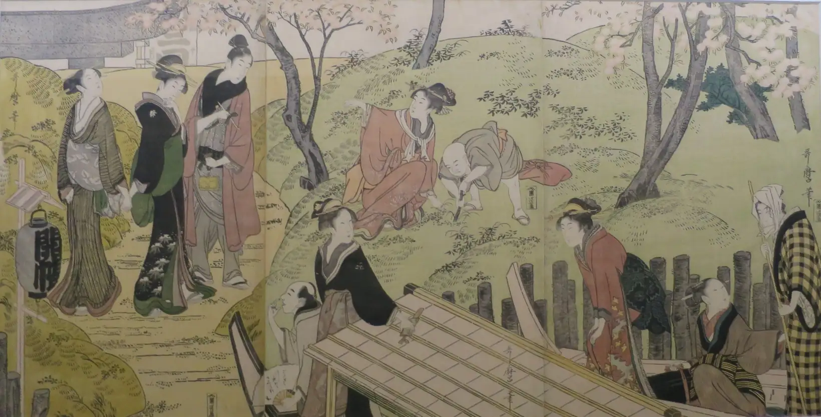
Description
Japan possesses two of the world’s longest and most precisely dated instrumental-analogue climate records — the cherry blossom flowering dates at Kyoto (documented since 812 CE) and the Lake Suwa freezing dates (recorded continuously since 1444 CE). Together with the documentary record of the great famines of the Edo period, they constitute a uniquely rich archive of climate variability across the Medieval Warm Period and the Little Ice Age in East Asia.
H.H. Lamb drew on both records in Climate, History and the Modern World to demonstrate that Japan’s climate history tracked the same broad hemispheric pattern seen in Europe — warm springs in the early medieval period, a sustained cold phase during the Little Ice Age with its peak severity between 1500 and 1520 and again around 1700–10 and 1850–80, and catastrophic famines when cold volcanic summers struck a population already under climatic stress.
Japan — Cherry Blossom Proxy, Lake Suwa Ice Record, and the Great FaminesLer maisRussia and Siberia — Climate Record from the Ice Age to 1900 CE
Location: European Russia, the Urals, Western and Central Siberia, the Altai, the Caucasus, Crimea, Central Asian steppes
Continent: Asia (and the Eurasian continental interior)
BP ranges covered: 20,000+ / 12,000–20,000 / 08,000–12,000 / 05,000–08,000 / 03,000–05,000 / 02,000–03,000 / 01,500–02,000 / 01,000–01,500 / 00,500–01,000 / 00,100–00,500
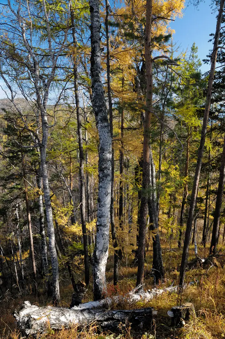
At Byzovaya on the middle Pechora River — the site Lamb refers to as Vyzovsk — more than 300 stone artefacts and several thousand animal bones were excavated from river-terrace deposits at 65°N. Radiocarbon dating places occupation at approximately 29,000–34,000 BP (34,580–31,370 cal yr BP). The faunal assemblage is overwhelmingly dominated by mammoth remains (97.7% of identified bones), with minor contributions from reindeer, horse, wolf, brown bear, and musk ox.
The site is one of the northernmost Upper Palaeolithic sites in Europe and represents human habitation at the edge of the glacial world. The initial colonisation of the Ural corridor took place during a relatively favourable phase of Marine Isotope Stage 3, when only small mountain glaciers existed in the region. The mammoth-dominated fauna signals a cold, open periglacial landscape — a mammoth steppe rather than the closed boreal forest that would later occupy the same latitude in the Holocene.
Russia and Siberia — Climate Record from the Ice Age to 1900 CELer maisAlpine Lake Settlements, Hallstatt Salt Mines and the Bronze Age Neoglacial Catastrophe
Location: Central Europe — Swiss and Austrian Alps, Lake Constance (Bodensee), Hallstatt (Salzkammergut), Hohe Tauern (Austria)
Continent: Europe · BP range: bp-02000-06000 (multi-period file spanning warm optimum through Neoglacial)
Geographic scope: Alpine region broadly — from the Swiss Mittelland to the Austrian Tyrol; Scandinavian parallels noted
Related file: alpine-mines-aqueducts-bridges-warm-cold-cycles.html (Roman through Little Ice Age cycles, the “sequel” to this file)
Description
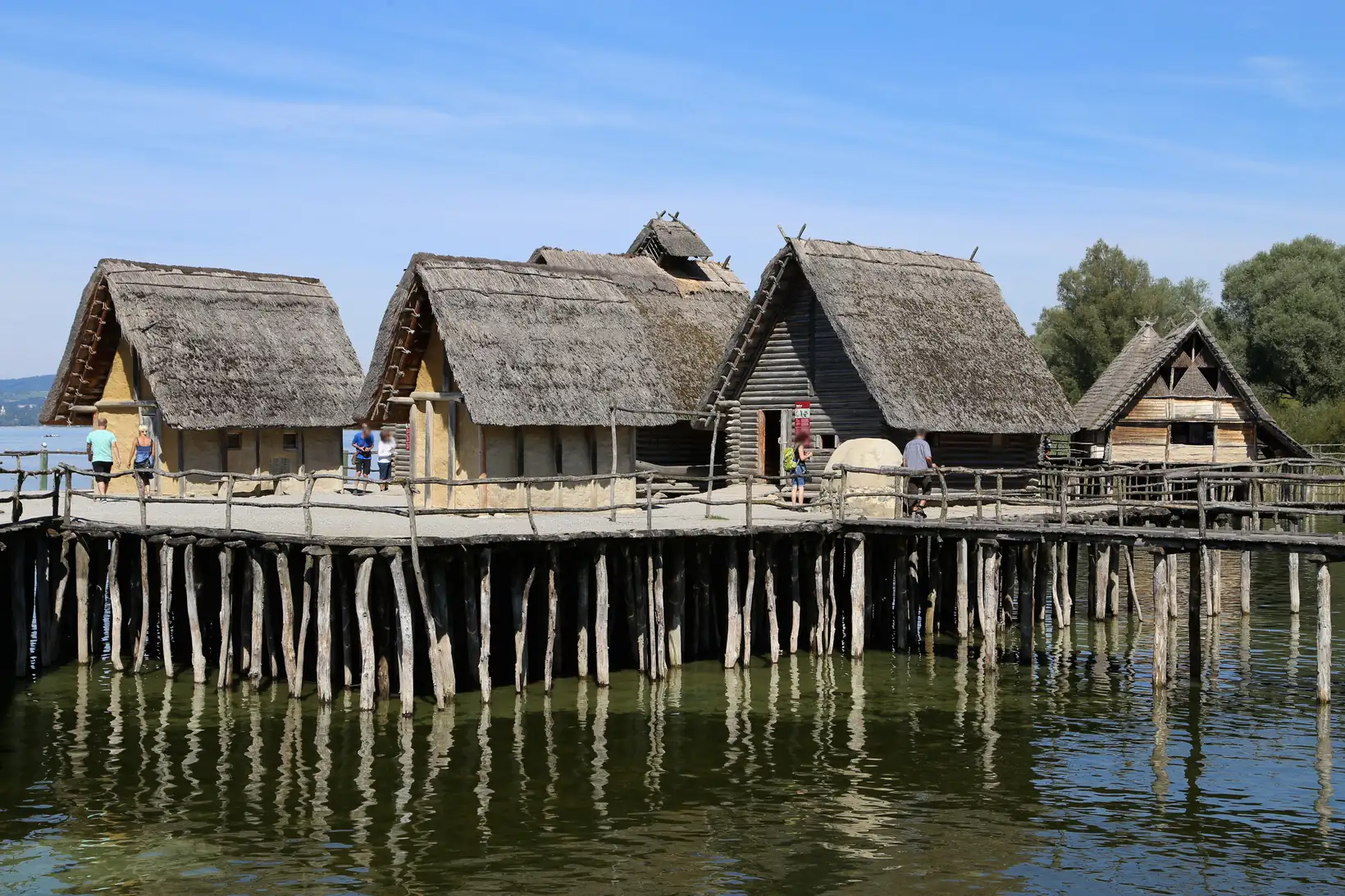
Between roughly 4000 and 2400 BC, during the warmest post-glacial centuries, the peoples of central Europe built their homes on wooden piles at the edges of Alpine and sub-Alpine lakes. Hundreds of such settlements — known in German as Pfahlbauten — have been identified across Switzerland, Austria, Germany and northern Italy, including the Burgäschisee and Thayngen in Switzerland and the Federsee in the Alpenvorland (German Alpine foreland). These were not marginal refuges but thriving communities, sustained by warmth sufficient to allow farming to extend above the Alpine forest limit and to fuel gold mining in the high passes of the Hohe Tauern. The Hallstatt salt mines near Salzburg would eventually make this Alpine world spectacularly wealthy.
That world was destroyed twice. Around 1300 BC, catastrophic lake flooding drove the pile-dwelling communities from their homes and set off a cascade of population movements across Eurasia. After a brief warm recovery around 1000 BC, when new settlements were built and high-altitude farming resumed, a second and final climate deterioration struck after 800 BC. What geologists call the Neoglacial — the first serious glacier advance since the post-glacial warm optimum — brought glaciers crashing down over the Hohe Tauern gold mines, blocked the Alpine passes, and around 500 BC raised Lake Constance by approximately 10 metres, drowning the last lake settlements. The Hallstatt salt civilization, one of the wealthiest and most sophisticated societies in prehistoric Europe, was extinguished. The forests changed their composition — oaks and broadleaves retreating before firs and spruces. Alpine population fell to a minimum, confined to the warmest valleys. In Scandinavia, the same events seem to have been seared into cultural memory as the Fimbulvinter — the mythological “great winter” before the end of the world.
Alpine Lake Settlements, Hallstatt Salt Mines and the Bronze Age Neoglacial CatastropheLer maisAlpine Mines, Aqueducts and Bridges — Three Cycles of Warm-Period Industry and Cold-Period Abandonment
Location: Alps and their flanks (Austria, Switzerland, Italy, France, Germany) — Hohe Tauern (AT), Aletsch/Saastal (CH), Palermo/Sicily (IT), Avignon (FR), Goslar/Harz (DE), Bohemia (CZ)
Continent: Europe · BP range: bp-00200-00300 through bp-01500-02000 (multi-period file)
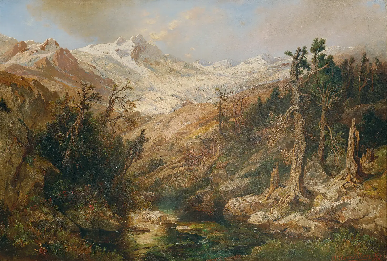
In the autumn of 218 BC, the Carthaginian general Hannibal Barca led an army of approximately 50,000 infantry, 9,000 cavalry, and 37 war elephants across the Alps into Italy — one of the most celebrated military feats in history. The crossing, recorded in detail by the Roman historian Polybius (who interviewed surviving veterans and later walked the route himself) and by Livy, required traversing high passes that today carry permanent snow and ice. Polybius describes rockfalls, narrow ledges, and fresh snowfall on older snow — but critically, the passes were traversable by a large army with pack animals and elephants, implying glacier and snow cover significantly less extensive than in later centuries.
Lamb places the Roman centuries squarely within a warm phase. On p. 167 he notes that by the first century AD beech trees, which had grown in Rome around 300 BC during a cooler interval, were “regarded by the Romans in Pliny’s day as a mountain tree” — warmth had pushed their habitat uphill. On p. 137 he records that “the elephants which were still present in Algeria in Hannibal’s time were evidently a remnant already isolated from the main stock in central Africa by the Sahara Desert” — placing Hannibal within the broader context of a drying Sahara and warming Mediterranean.
Alpine Mines, Aqueducts and Bridges — Three Cycles of Warm-Period Industry and Cold-Period AbandonmentLer maisThe Late Bronze Age Collapse (~1200 BC) — Climate, Drought and the Simultaneous Fall of Civilizations
Location: Eastern Mediterranean and Near East — Mycenae (Greece), Minoan Crete, Hattusa (Anatolia/Turkey), Egypt, Mesopotamia (Babylon), the Levant
Continent: Europe / Asia / Africa · BP range: bp-02000-03500 (spanning ~3450–2750 BP; multi-civilizational)
Geographic scope: Entire eastern Mediterranean basin and Near East — the broadest synchronous collapse in ancient history
Description
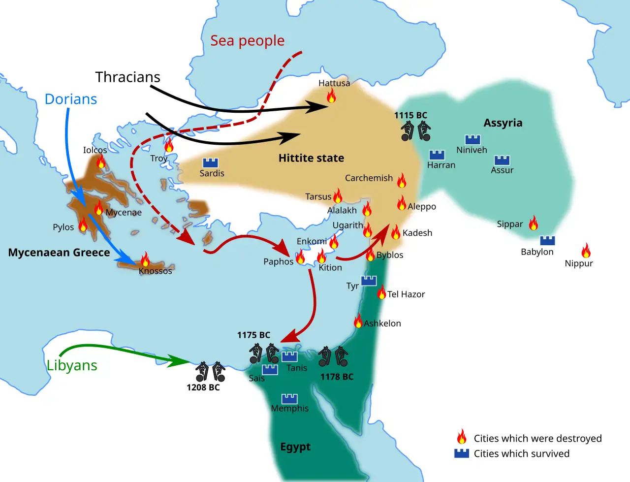
Around 1200 BC, within a single generation, every major civilization in the eastern Mediterranean collapsed or was severely disrupted. The Mycenaean palace economy of Greece disintegrated; the Hittite Empire abandoned its Anatolian heartland; the Levantine coastal cities of Ugarit and Alalakh were burned and never reoccupied; Egypt was invaded simultaneously from three directions; Minoan Crete, already shattered by the Santorin eruption two centuries earlier, was left “virtually uninhabited” by famine and pestilence. This was not the sequential fall of one state replaced by another — it was a synchronous civilizational collapse spanning 3,000 kilometres of coastline.
H.H. Lamb synthesises the evidence that the common driver was climatic: a sustained deterioration that had been under way since the warmth of the early second millennium BC, culminating in severe droughts around 1200 BC. The drought thesis — first put forcefully by the American archaeologist Rhys Carpenter in the 1960s — has since been confirmed by pollen cores, tree-ring chronologies, speleothems and lake sediment records that all register the same signal: the eastern Mediterranean became substantially drier and more variable in the twelfth century BC.
The Late Bronze Age Collapse (~1200 BC) — Climate, Drought and the Simultaneous Fall of CivilizationsLer maisDark Ages Cold Period — Drought, Plague, Migration and the Fall of the Classical World
Location: Europe, Mediterranean Basin, Central Asia, Arabia, Nile Valley
Continent: Europe (primary) · evidence spans Asia, Africa, Americas
BP range: bp-01000-01500 (covering 450–950 CE); also bp-01500-02000 (50 BCE–450 CE) for transition
Lamb reference: Climate, History and the Modern World (1995), pp. 168–179
Description
The five centuries from approximately AD 300 to 900 constitute one of the most catastrophic episodes in the history of human civilization, a period of converging environmental and biological stresses that Lamb explicitly compared to the Little Ice Age of AD 1400–1900. The Roman Warm Period — a centuries-long interval of mild winters, reliable harvests, and expanding agriculture that had underwritten the prosperity of classical antiquity — ended around AD 400. What followed was a cascade of interlocking crises: progressive desiccation of Central Asian grasslands, mass migrations of nomadic peoples westward into Europe, a series of devastating plagues culminating in the Justinianic Pandemic of AD 542–565, abandonment of major cities across the Mediterranean and the Near East, and a volcanic-induced cold shock in AD 536–540 that modern researchers now call the Late Antique Little Ice Age (LALIA).
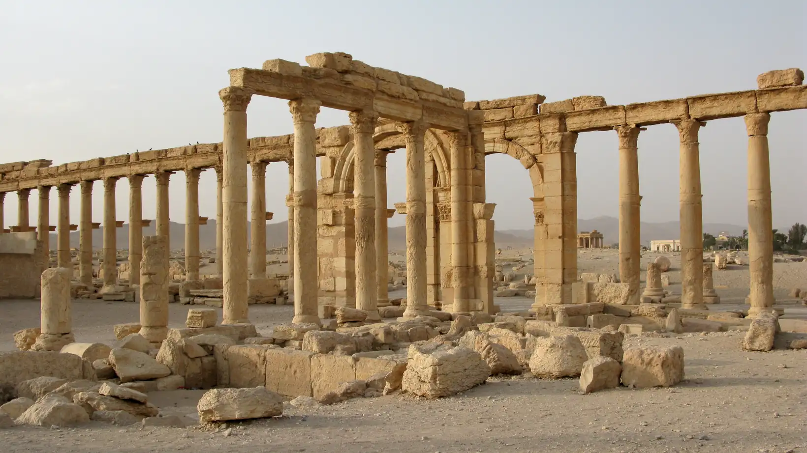
Lamb’s narrative is built on physical proxy evidence — old shorelines of inland seas, glacier positions, tree rings — and on the convergence of this physical record with the documentary testimony of contemporaries including the Byzantine historian Procopius, the decline of urban archaeology across Palmyra, Ephesus, and Antioch, and the administrative collapse of the Roman state. Modern scholarship has substantially confirmed and deepened Lamb’s interpretation, particularly through ancient DNA analysis of Yersinia pestis from Justinianic-period burial sites and through the Büntgen et al. (2016) tree-ring reconstruction of the volcanic cooling events of AD 536 and 540.
Dark Ages Cold Period — Drought, Plague, Migration and the Fall of the Classical WorldLer maisJutland Farm Abandonment and Agricultural Collapse — Denmark
Location: Jutland peninsula (Jylland) and Scania (Skåne), Denmark
Continent: Europe · BP range: 250–1050 (spanning bp-00200-00300 through bp-00900-01000)
Description
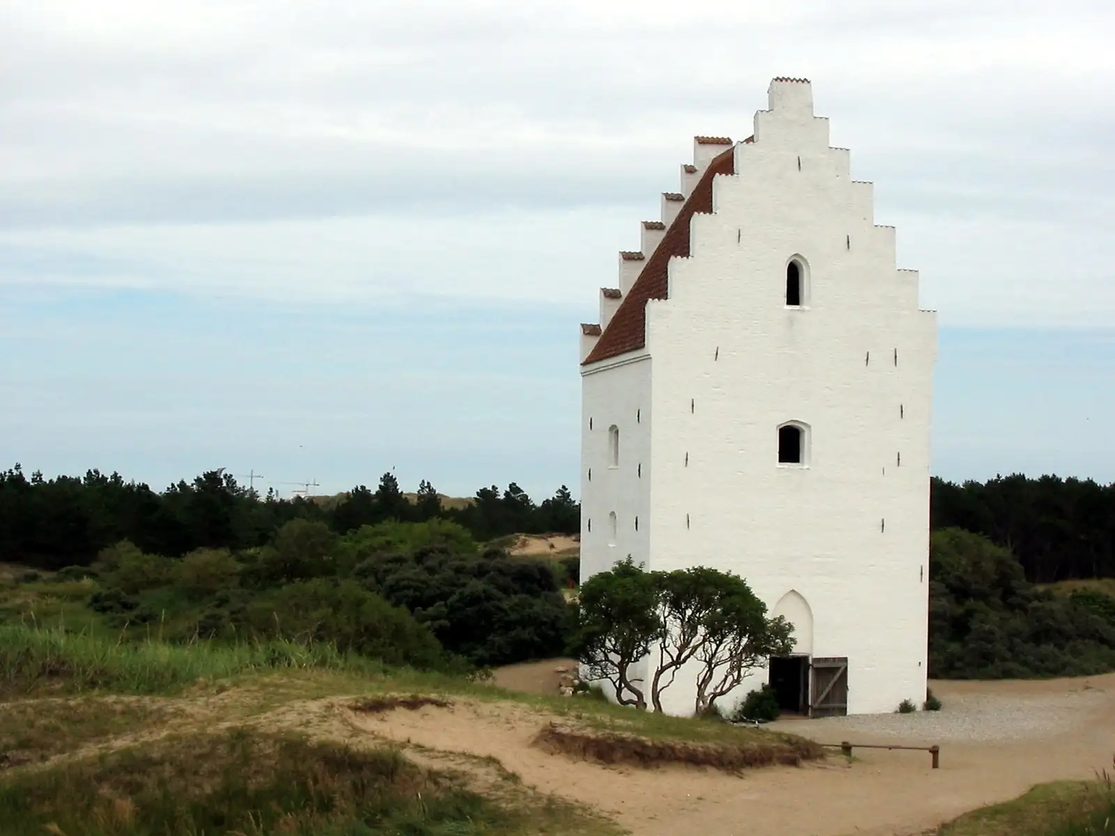
Denmark’s Jutland peninsula offers one of the most clearly documented cases in northern Europe of a medieval agricultural society shaped by climate, then broken by it. During the Medieval Warm Period (roughly 900–1300 CE), Denmark was prosperous enough to extract a third of its royal income from the Scania herring fishery alone, to compile a detailed land cadastre recording hundreds of productive farms, and to expand settlement across heathland and coastal margins that had previously been too harsh to cultivate. Then, as the Little Ice Age took hold after 1300, the same landscape unravelled: farms across Jutland were deserted, corn-growing was given up, shared tenancies replaced single-family holdings, sand buried churches and fields, the herring vanished from the Baltic, and English visitors in 1406 reported a land of “much sodden uncultivated ground.”
The evidence spans complementary strands — fiscal documents (Kong Valdemars Jordebog), eyewitness chronicles (the 1406 English wedding party), archaeological monuments (Den Tilsandede Kirke), scholarly surveys of deserted farms (the Nordic Ødegårdsprosjekt), and the documented collapse of the Scania herring market — each pointing independently to the same climatic narrative:
Jutland Farm Abandonment and Agricultural Collapse — DenmarkLer maisDutch Golden Age — North Sea Maritime Prosperity to Little Ice Age Storms (~1400–1720)
Location: Netherlands (Holland, Zeeland, Friesland), North Sea coastal plain
Continent: Europe · BP range: 230–550
Description
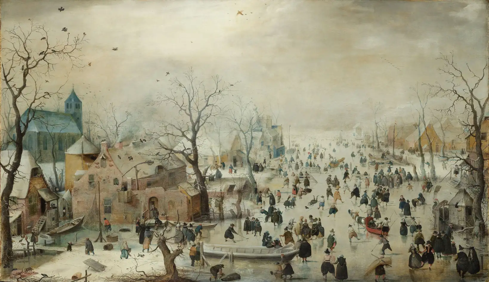
For roughly two centuries, the climate of the North Sea basin handed the Dutch an extraordinary economic gift: the herring moved. As Baltic waters cooled and became inhospitable to the shoals that had sustained Scandinavian and Hanseatic commerce, the fish migrated westward into the warmer North Sea. Holland, positioned at the intersection of Atlantic trade routes, seized on this windfall with characteristic ingenuity — purpose-built vessels, salt-curing at sea, industrial windmills, and the legal and financial infrastructure of the world’s first joint-stock company. The result was the Dutch Golden Age: an era of unprecedented prosperity, artistic achievement, and maritime power compressed into fewer than a hundred years.
Then the climate tightened again. The late seventeenth century brought an intensification of storms and cold that simultaneously disrupted the fisheries, froze the canals, broke the dykes, and inundated the coastal plain. The same low-lying geography that made Holland rich — polders reclaimed from the sea, canal networks spanning every district — became catastrophically vulnerable when the storms came. The arc from warmth to catastrophe is documented in fishing records, municipal chronicles, hydrological surveys, storm engravings, and the canvases of the Dutch masters themselves.
Dutch Golden Age — North Sea Maritime Prosperity to Little Ice Age Storms (~1400–1720)Ler maisDeserted Medieval Villages of England — Whatborough, Wharram Percy, and the Post-1300 Collapse
Location: England — East Midlands (Leicestershire, Warwickshire), Yorkshire, Dartmoor, and country-wide
Continent: Europe · BP range (core collapse): 500–700 BP (1250–1450 CE)
Description
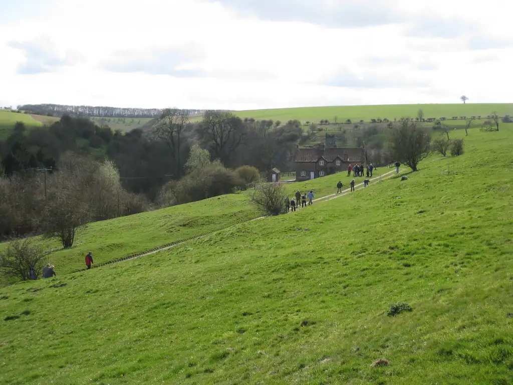
The story of England’s deserted medieval villages is one of the most compelling pieces of evidence for the reality of natural climate variability in historical times. It has two indispensable halves: the warmth that made prosperity possible, and the cooling that destroyed it.
During the Medieval Warm Period (roughly 900–1300 CE), England enjoyed summer temperatures that Lamb estimates were 0.7–1.0°C above the twentieth-century average. This was not a marginal difference. It pushed the frontier of profitable cultivation to elevations never again achieved — to 400 m on Dartmoor and 320 m in Northumberland. It sustained vineyards as far north as Yorkshire. It generated the agricultural surplus that built cathedrals, funded crusades, and supported a population of perhaps five to six million.
Deserted Medieval Villages of England — Whatborough, Wharram Percy, and the Post-1300 CollapseLer maisFrance 1690–1789: From the Abyss to Revolution — The Warm-Cold Arc
Location: France, England, Switzerland, Scandinavia — Western and Central Europe
Continent: Europe · BP range: bp-00100-00300
Event: A century-long arc from the deepest cold of the Little Ice Age (1690s) through the warmest and most prosperous decades of the 18th century (1718–1780), ending in the climate-driven famine crisis of the 1780s that primed the powder-keg of the French Revolution
Description
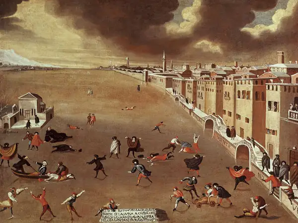
The cold of the 1690s is not impressionistic. The early thermometer record for England — assembled from scattered instrument readings and later systematised by Gordon Manley into the Central England Temperature series — puts precise numbers on the disaster. Lamb states: “In England the late seventeenth-century thermometer record indicates annual mean temperatures about 0.9 degrees C lower than in the period 1920–60. Over the years 1690–9 the deficit was 1.5 degrees C.” Across the decade as a whole, England was 1.5°C below what would become the 20th-century baseline — a shift large enough to shorten the growing season by approximately five weeks and eliminate the surplus that kept marginal land viable.
The summers of the 1690s were “probably more important economically than the severity of the winters,” as Lamb notes: it was cold, wet summers that failed the harvest, not merely cold winters. In England the growing season was “shortened on the long-term (30–50 years) average by about 5 weeks in comparison with the warmest decades of the twentieth century.” This is the equivalent of moving England’s agricultural zone half a degree of latitude northward — beyond the margin of viability for many crops on marginal land.
France 1690–1789: From the Abyss to Revolution — The Warm-Cold ArcLer maisFrozen Thames & Little Ice Age Winter Extremes, 1400s–1814
Location: London and England, with European-wide context (Netherlands, France, Baltic, Scandinavia)
Continent: Europe · BP range: 100–550
Description
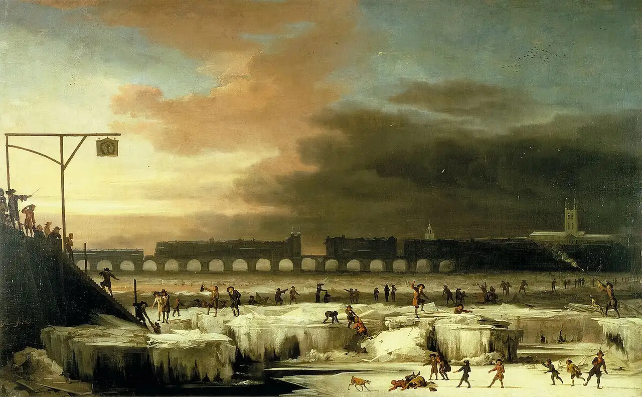
Between roughly 1400 and 1814, the River Thames froze at London on at least twenty to twenty-two occasions — a phenomenon that has not recurred since. Each freezing required sustained temperatures cold enough to overcome the tidal action of a broad, slow-moving river in one of Europe's most populous cities. The frost fairs held on the ice, the diaries of horrified witnesses, the catastrophic agricultural losses, the abandoned vineyards, and the bones of the last wolves shot in Scotland all belong to the same climatic episode: the Little Ice Age, during which mean annual temperatures across England and continental Europe were consistently 1–2°C below the levels of the twentieth century.
The Thames freezings are the most vivid symptom of something far more consequential: recurring extreme winters that killed livestock, destroyed harvests, halted shipping, drove up food prices, and periodically overwhelmed entire agricultural systems. The evidence for this period is exceptionally rich — combining the world’s longest instrumental temperature record with eyewitness diaries, frost-fair pamphlets, painters’ canvases, royal society letters, tax registers, and the physical engineering history of the river itself.
Frozen Thames & Little Ice Age Winter Extremes, 1400s–1814Ler maisThe Great Famine of 1315–1322: Continental Europe’s Warm-to-Cold Reversal
Location: Continental Europe — France, the Low Countries (Flanders, Bruges, Ypres), Germany, Poland, Scandinavia
Continent: Europe · Core BP range: bp-00600-00700
Event: The sharpest documented climate reversal of the medieval period: from the warm prosperous decades of 1284–1311 to the catastrophic cold and wet sequence of 1313–1322, producing the deadliest peacetime famine in European history
Description
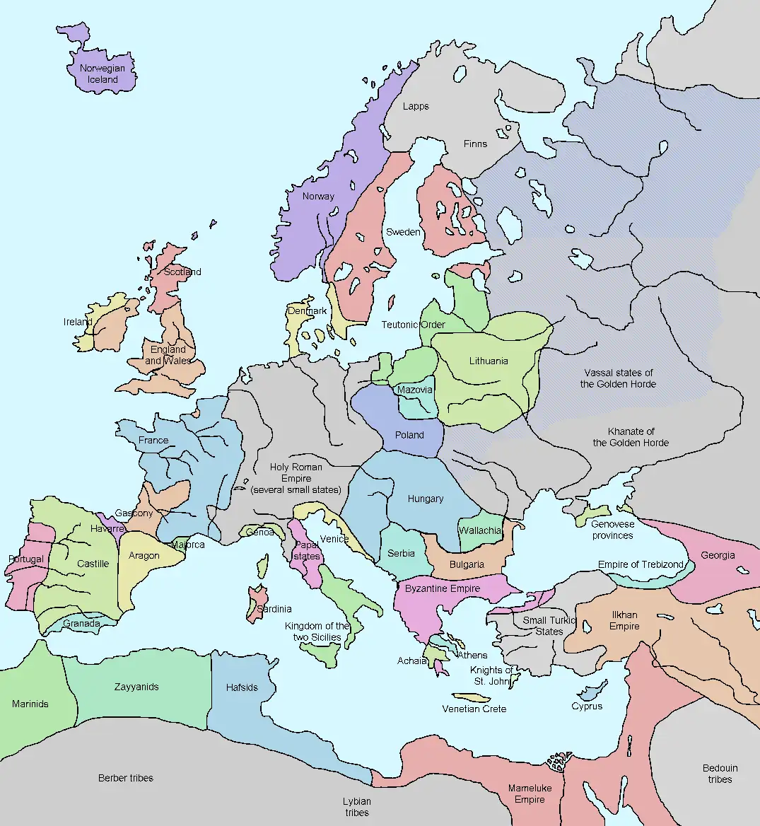
Between 1284 and 1311, continental Europe enjoyed one of its most climatically benign eras since the height of the Roman Warm Period. Vineyards pushed into latitudes that had not seen them before; new settlements crept up hillsides and into upland valleys; Norwegian farmers grew barley within 250 km of the Arctic Circle; the cloth towns of Flanders — Bruges, Ypres, Ghent — swelled with population fed by reliable grain surpluses from the Rhine basin and the Baltic littoral; German wine harvests were rated “good” in 30–70% of years. Then, beginning in the late summer of 1313, the rains came and did not stop.
What followed across the continent from 1315 to 1322 was not a localized crop failure but a systemic breakdown of the entire northern European agricultural system. In Flanders, the saturated low-lying polders flooded. In the Rhine valley, the vines rotted unpicked. In Denmark, farms were left in sodden abandonment. In the Harz Mountains, rising groundwater inundated the silver mines that financed the Holy Roman Empire. In Bohemia, the Kutna Hora silver mines began flooding so severely that some had to be abandoned entirely by 1321. In Scandinavia, grain never fully ripened. Across France, Poland, and the Low Countries, chroniclers documented what no living person had seen: grain still green and unripe at harvest time, year after year, across the entire continent simultaneously.
The Great Famine of 1315–1322: Continental Europe’s Warm-to-Cold ReversalLer maisIceland: From Grain Fields to Starvation — The Warm/Cold Contrast (870–1960 CE)
Location: Iceland — North Atlantic, 63–66°N
Continent: Europe · Core BP ranges: bp-00000-00100 through bp-00900-01000
Event: Eleven centuries of documented climate-driven oscillation between agricultural prosperity and population collapse, uniquely preserved in tax records, archaeological strata, sea ice logs, glacier moraines, and cod fishery records
The Central Contrast
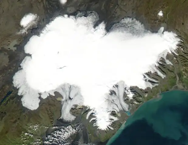
No country in Europe presents a starker or more completely documented record of climate's power over human civilization than Iceland. When Norse settlers arrived in the 860s CE, they found an island warm enough to grow barley and oats, covered in birch woodland, with open seas that had carried Irish monks there decades before. By the late 17th century, that same island was encircled by sea ice for months at a time, its grain fields long abandoned, its cod fishery collapsed, its glaciers grinding over occupied farmsteads, and its population reduced from a medieval peak of roughly 77,500 to fewer than 38,000 — a loss of more than half, achieved not by war or epidemic alone but by the slow, inexorable pressure of cold.
The evidence is exceptional in its breadth: tax records from 1095 counted the population at its height; pollen cores show the moment grain cultivation ceased; archaeological strata at the farm of Kvisker reveal a site that shrank and impoverished itself across a thousand years of occupation; sea ice logs document the exact years ice surrounded the island; and the heights of human skeletons fell by 6 centimetres between the 10th and 18th centuries — a biological signature of chronic nutritional stress. Lamb called this “a historical development which runs fairly closely parallel to the temperature curve.”
Iceland: From Grain Fields to Starvation — The Warm/Cold Contrast (870–1960 CE)Ler maisLapland: Warm Anomaly During the Early Little Ice Age
Location: Finnish and Swedish Lapland (67–69°N), Fennoscandia
Continent: Europe
BP range: 350–550
Evidence types: Dendrochronological · Documentary · Fiscal · Archaeological · Atmospheric science
Description
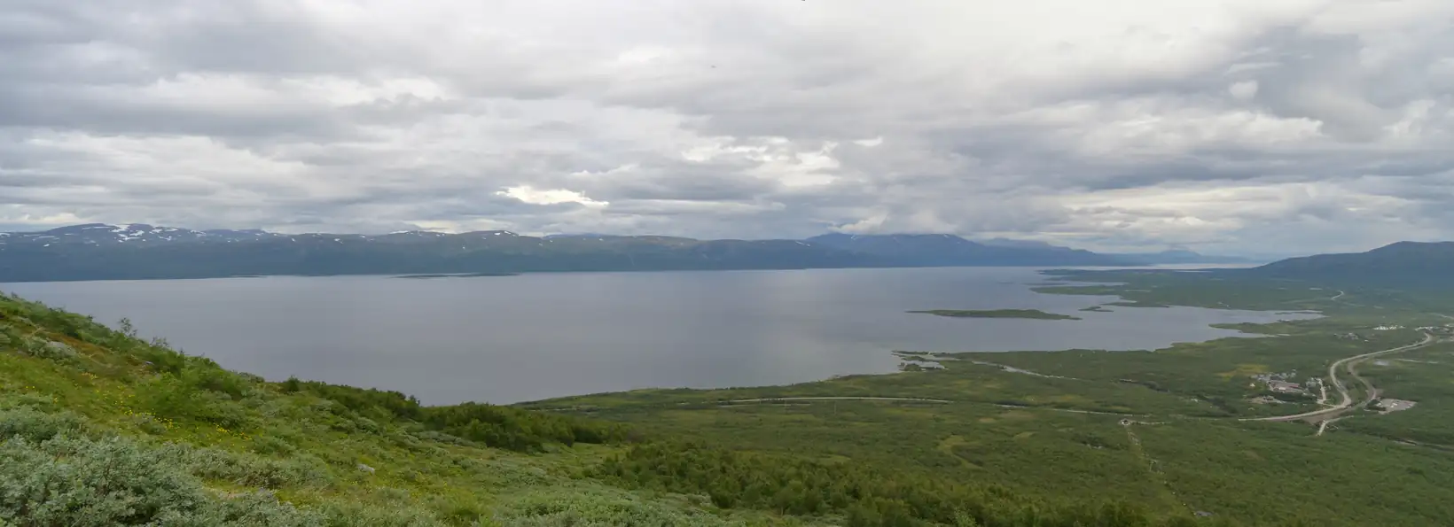
While the 15th and 16th centuries are known in European history as a period of climate deterioration — failed harvests, abandoned highland farms, advancing glaciers, and the onset of what we now call the Little Ice Age — tree-ring records from Finnish and Swedish Lapland tell a strikingly different story. Tree growth was exceptionally good during precisely the same period that central Europe was suffering its worst climate in centuries. This paradox is not accidental: it reflects a specific atmospheric pattern in which blocking anticyclones over the high north created warm, sunny conditions at extreme latitudes while channeling cold Arctic air southward into the mid-latitudes.
Lamb recognized this pattern explicitly on p. 291 of Climate, History and the Modern World, and the subsequent development of megachronologies in Finnish and Swedish Lapland — some of the longest tree-ring records in the world, built from thousands of living and subfossil pines — has confirmed and quantified the signal he identified. The mechanism — blocking anticyclones over Scandinavia that split the westerlies during the early LIA — has now been confirmed by modern climate science in a 2022 paper in Nature Communications. The same warm signal appears simultaneously in Alaska and the Yukon, confirming a planetary-scale pattern.
Lapland: Warm Anomaly During the Early Little Ice AgeLer maisNorthwest Siberia — Anomalous Warmth in the 1690s While Europe Froze
Location: Northwest Siberia: Yamal Peninsula, Ob–Taz river system, West Siberian Plain
Continent: Europe
BP range: bp-00200-00300 (1650–1750 CE)
Climatic event: Atmospheric blocking seesaw — simultaneous cold in Europe and warmth in NW Siberia
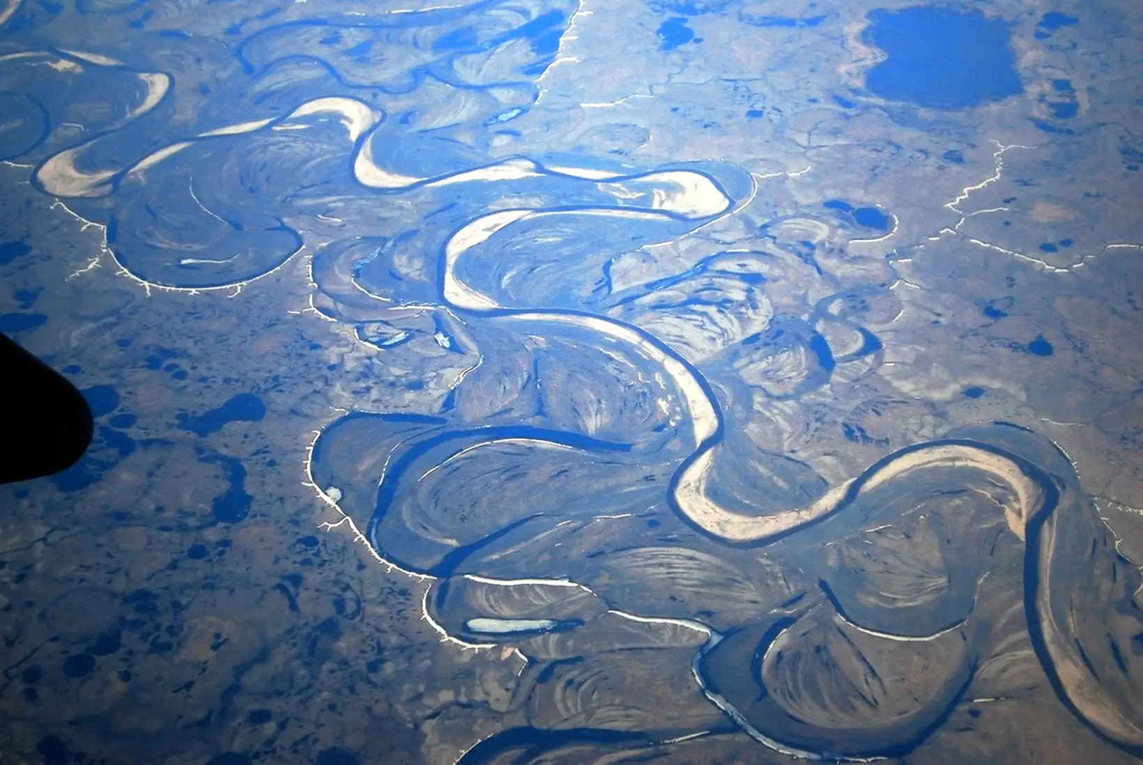
Description
The 1690s marked the absolute coldest phase of the Little Ice Age across northern, western and central Europe. Scotland’s “Seven Ill Years” (1695–1703) killed roughly a fifth of the Scottish population; France endured its worst famine of the century; Scandinavia recorded catastrophic harvest failures; the Thames froze in London; and the Norwegian Sea drove persistent northerly and northwesterly winds across the continent. Yet at precisely this moment, northwest Siberia — the Yamal Peninsula, the lower Ob basin, the Taz river country — was experiencing great warmth.
H.H. Lamb drew attention to this paradox in Climate, History and the Modern World, noting that travellers’ observations of the Siberian landscape and lakes documented conditions strikingly warmer than the European norm. The explanation is atmospheric: when a persistent blocking high establishes itself over northeastern Europe, it simultaneously forces northerly winds across Europe and diverts warm southerly air into northwest Siberia — a classic hemispheric seesaw driven by meridional (north–south) circulation. The Late Maunder Minimum (1675–1715), with its greatly reduced solar output and its tendency to push the North Atlantic Oscillation into a negative phase, was precisely the kind of forcing that would amplify and sustain such blocking configurations.
Northwest Siberia — Anomalous Warmth in the 1690s While Europe FrozeLer maisAbandoned Farms and the Seven Ill Years — Lammermuir Hills and Southern Uplands, Scotland
Location: Lammermuir Hills (East Lothian / Scottish Borders) and broader Scottish Southern Uplands
Continent: Europe · BP range: 200–650 (files covering 1300–1700 CE span bp-00200-00300 through bp-00600-00700)
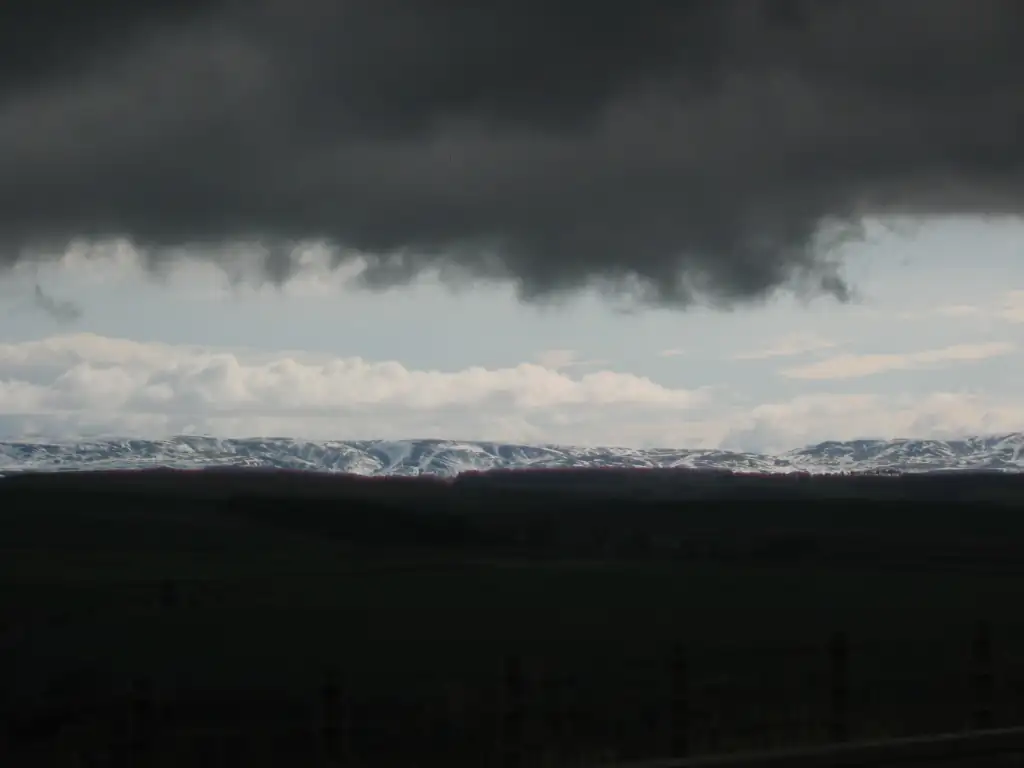
Description
Scotland’s southern uplands provide the most precisely documented example in the British Isles of how climate shaped the rise and fall of an agricultural society. During the Medieval Warm Period (roughly 1000–1300 CE), Scotland experienced a “golden age”: farms pushed high into the glens, abbeys managed vast highland estates, and the country was prosperous enough to shelter refugees from Norman England. Then, over three centuries of cooling, the viable agricultural margin contracted step by step — culminating in the catastrophic harvests of 1693–1700, the “Seven Ill Years,” which killed approximately one-third of the upland population, triggered mass emigration to Ulster and the Americas, and almost certainly made political union with England in 1707 seem inevitable to the devastated country.
The evidence spans multiple complementary strands, with quantitative agro-climatic analysis by M.L. Parry cross-confirming the documentary record in the Statistical Account of Scotland, physical archaeological remains at the abandoned village of Daintoun, fiscal and economic records compiled by Lythe and Smout, and meteorological observations published in the Philosophical Transactions of the Royal Society:
Abandoned Farms and the Seven Ill Years — Lammermuir Hills and Southern Uplands, ScotlandLer maisAbandoned Farms and Contracted Cultivable Area around Trondheim Fjord
Location: Trøndelag region, central Norway; Trondheim fjord and surrounding upland districts
Continent: Europe · BP range: 600–700
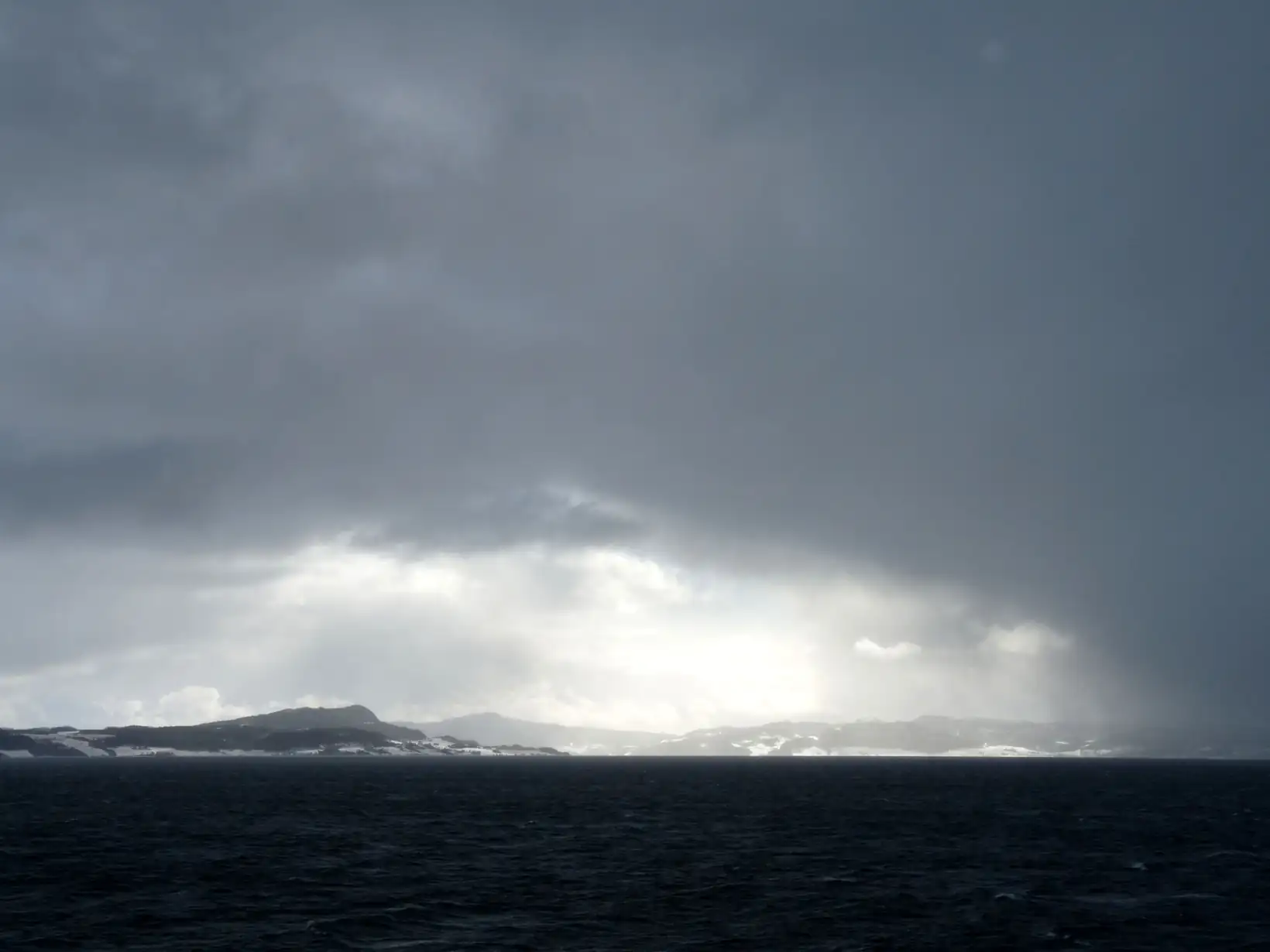
Description
Trøndelag (the district surrounding Trondheim fjord, central Norway) provides one of the most documented cases in northern Europe of cultivable land contraction driven by climate deterioration. When prevailing southwest winds — which bring mild, moist Atlantic air and sustain marginal grain cultivation — gave way to more frequent northerly and northeasterly winds, growing conditions deteriorated sharply along the fjord margins and in the upland districts. Former settlements were abandoned and the receding farmland was reconquered by birch and conifer forest.
The evidence spans multiple complementary strands — but the decline can only be understood against the backdrop of the remarkable prosperity that preceded it:
Abandoned Farms and Contracted Cultivable Area around Trondheim FjordLer maisVineyards as Climate Proxy — The Rise and Fall of European Wine Cultivation, 900–1550 CE
Location: England (south and midlands), southwest Germany (Baden), northern France
Continent: Europe · BP range: 400–1050 (spanning bp-00400-00500 through bp-00900-01000)
Evidence types: Documentary, Fiscal, Dendrochronological, Artistic
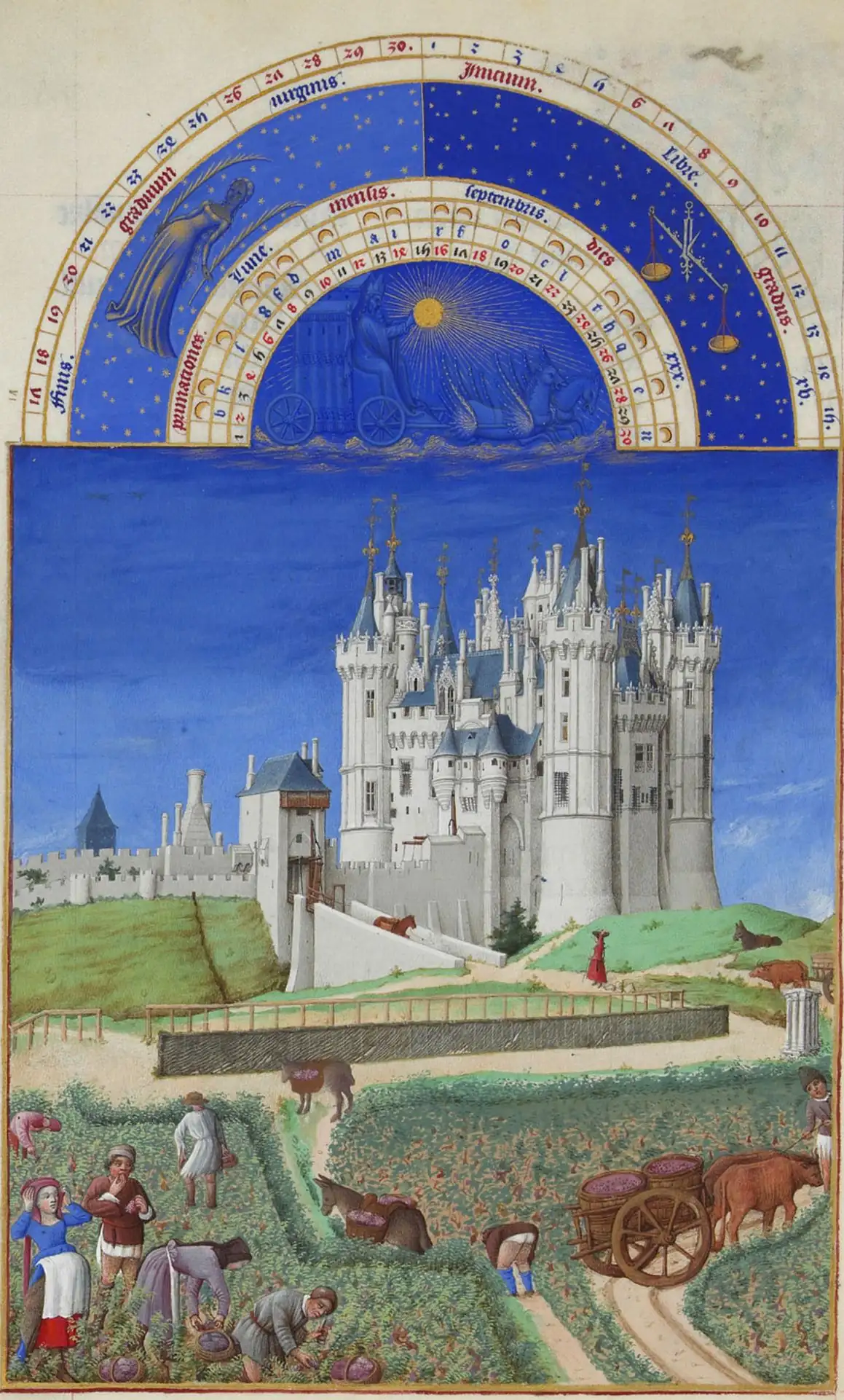
Description
Of all the historical evidence for the Medieval Warm Period and the subsequent Little Ice Age transition, perhaps none is more legible — or more contested — than the record of vine cultivation across northern Europe. Vineyards are exquisitely sensitive thermometers: the grapevine requires a minimum accumulated warmth during the growing season (roughly April through September) to bring fruit to ripeness, and this thermal threshold defines a climatic boundary that shifts measurably with temperature changes of less than one degree Celsius. When the climate warms, vines advance northward and upslope; when it cools, they retreat. The record of their advance and retreat, preserved in estate surveys, tax rolls, monastic chronicles, royal surveys, and the physical remains of former vineyard terraces, provides one of the most spatially explicit and precisely dateable proxies available for reconstructing medieval climate change.
The evidence presented here covers both phases: the Medieval Warm Period prosperity (roughly 900–1300 CE), when vines flourished as far north as southern Scotland and at altitudes well above their modern limits in Germany; and the Little Ice Age collapse (roughly 1300–1550 CE), when the same vineyards failed one by one, their stories documented in estate records, tax surveys, and the bitter notations of monastic keepers who watched the harvest quality decline decade by decade until the enterprise was abandoned entirely.
Vineyards as Climate Proxy — The Rise and Fall of European Wine Cultivation, 900–1550 CELer maisThe Year Without a Summer: Volcanic Climate Shocks, 1783–1855
Location: Global — Europe primary (Britain, Switzerland, France, Scandinavia); North America, Japan, Bengal
Continent: Europe (primary) · BP range: 100–200
Evidence types: Volcanic proxy, Instrumental, Documentary, Fiscal, Artistic/Literary, Ice Core, Glaciological
Description
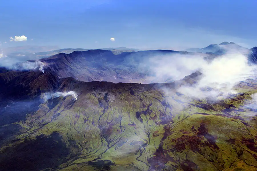
In April 1815 the Indonesian volcano Tambora detonated with a force unmatched in the historical record — Volcanic Explosivity Index 7, the largest eruption since the Hatepe eruption of around 232 CE. Its aerosol veil reached the stratosphere within weeks and spread across the globe, blocking solar radiation through 1816 and into 1817. Snow fell in June across eastern North America; grain rotted in the fields of Wales and Switzerland; cholera began its first modern pandemic in Bengal; and in Geneva, confined to a lakeside villa by relentless rain and cold, a young woman named Mary Shelley imagined a creature assembled from dead tissue and jolted to life by lightning.
But Tambora did not act alone. The Laki fissure system in Iceland had erupted thirty-two years earlier in June 1783, blanketing Europe in a sulphurous dry fog that killed crops in Scotland and left the sun invisible in southern France for weeks. Multiple eruptions between 1812 and 1815 — St Vincent, Awu, and the Philippines — had already loaded the stratosphere before Tambora fired. The resulting cooling persisted long enough to push Alpine glaciers into their most sustained advance in centuries and to inaugurate three decades of recurring economic and social crisis across the industrializing world.
The Year Without a Summer: Volcanic Climate Shocks, 1783–1855Ler mais